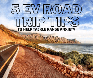
“Planning for the worst and still finding it — this is what it’s like driving an EV on the Dempster Highway.”
Doing the Dempster Highway is a bucket list road trip in any vehicle — let alone an electric one. For me, it was a dual-purpose journey.
Being from the Northwest Territories, this route has always had personal meaning. Driving it in an EV was a challenge I had been waiting for — a combination of adventure, technical preparation, and homecoming.
Here are my tips, takeaways, and highlights from what is by far the most incredible electric vehicle road trip I’ve done to date. And that’s saying a lot. I’ve now crisscrossed North America and Europe in an EV more times than I can count, with stunning scenery and unforgettable experiences along the way.
This EV road trip report starts from my home base in Vancouver and includes a ferry from Bellingham, Washington, up to Juneau and Haines, Alaska, before continuing overland to Dawson City and onto the iconic Dempster Highway. The story continues all the way to the Arctic Ocean in Tuktoyaktuk, Northwest Territories.
Preparing for the Dempster Highway in an EV
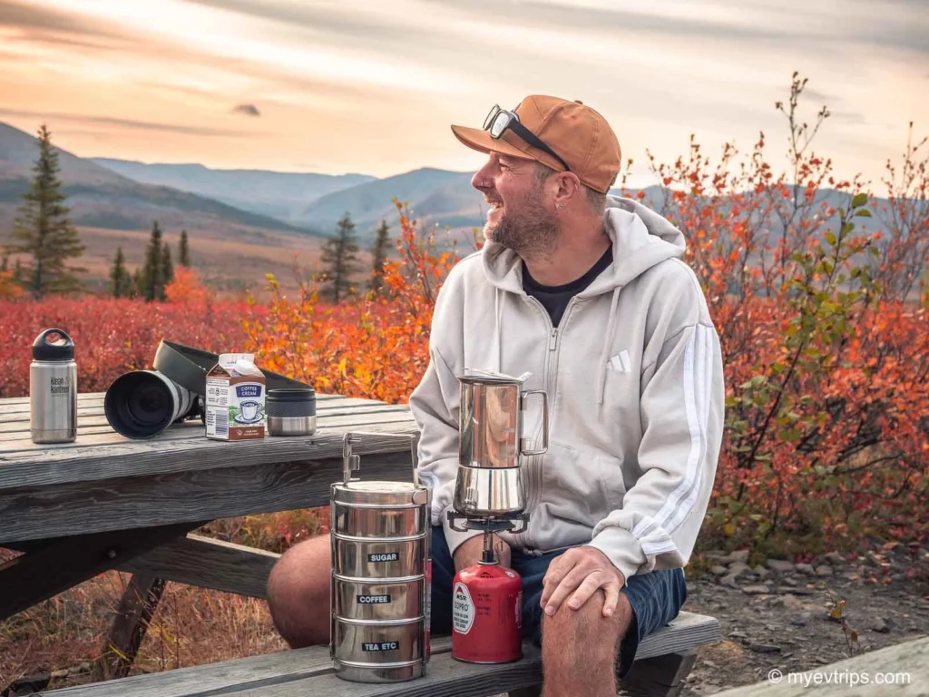
Before diving into the route, I want to emphasize that being prepared is what made this epic EV journey possible. The Dempster Highway is notorious for remote conditions, tire-slashing slate roads, and unpredictable weather. Doing it in an electric vehicle adds even more complexity. Here’s what I packed and what I’d recommend:
- A full-size spare tire — and in hindsight, I should have brought two. More on that later.
- A proper jack, lug wrench, tire patch kit (here’s the one I use), tire pump
- Back-up battery pack for powering accessories
- Lots of water, snacks, and a cooler
- Warm clothes, camera gear, and blankets
- Cleaning supplies like windshield washer, bug rags, and heavy-duty paper towel
- Starlink for internet on the go — this was absolutely game-changing
For more preparation tips, check out Dempster Highway EV road trip plan.
Leg 1: Vancouver to Haines, Alaska (via Alaska Marine Highway)
Many people asked why I took a ferry north instead of driving. It came down to two things: I’ve always thought it would be cool to ferry an electric vehicle to Alaska, and skipping several hundred kilometres of driving early in the trip helped conserve energy (mine and the car’s). Also, the views…
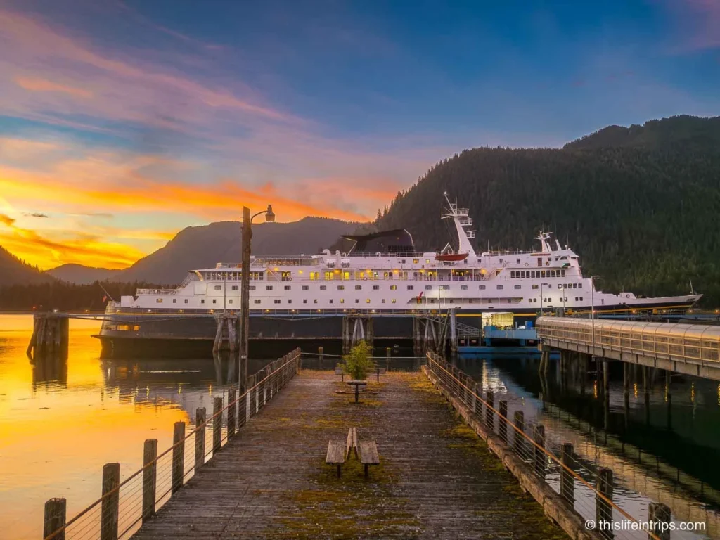
I departed Vancouver with a 90% charge, stopped in Bellingham to top up and grab snacks from Trader Joe’s, then arrived three hours before departure as required by the Alaska Marine Highway (full ferry guide here).
I was only able to trickle charge with a Level 2 charger near the terminal, so I boarded with less charge than I’d hoped — but knew I could top up in Juneau.
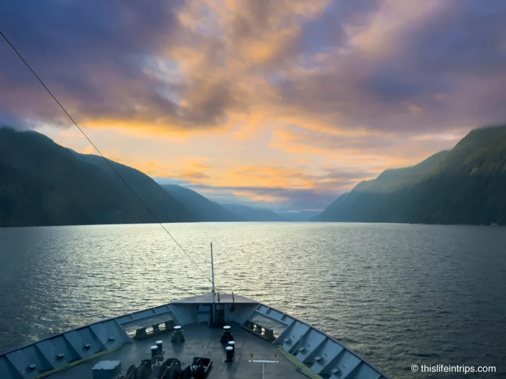
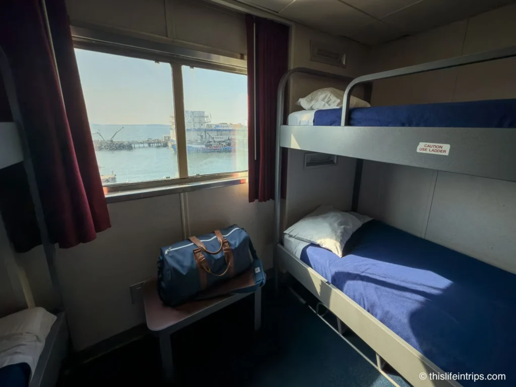
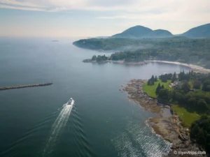
The ferry ride was unforgettable. Traveling the Alaska Marine Highway System (AMHS) felt like a true backcountry cruise — minus the crowds. Wildlife sightings were frequent, with whales breaching off the bow and eagles soaring overhead.
The ship we boarded from Bellingham wound its way through the Inside Passage, one of the most scenic water routes in the world. Towering fjords, snow-dusted peaks, and dense coastal rainforests surrounded us at every turn. The rhythm of the ship, the fresh ocean air, and the endless horizon combined to make this stretch feel both remote and restorative.
What made the experience even better was the ability to access my car during the journey. AMHS ferries allow pet owners and vehicle passengers to check in on their pets a few times a day, which I used to grab snacks from my cooler.
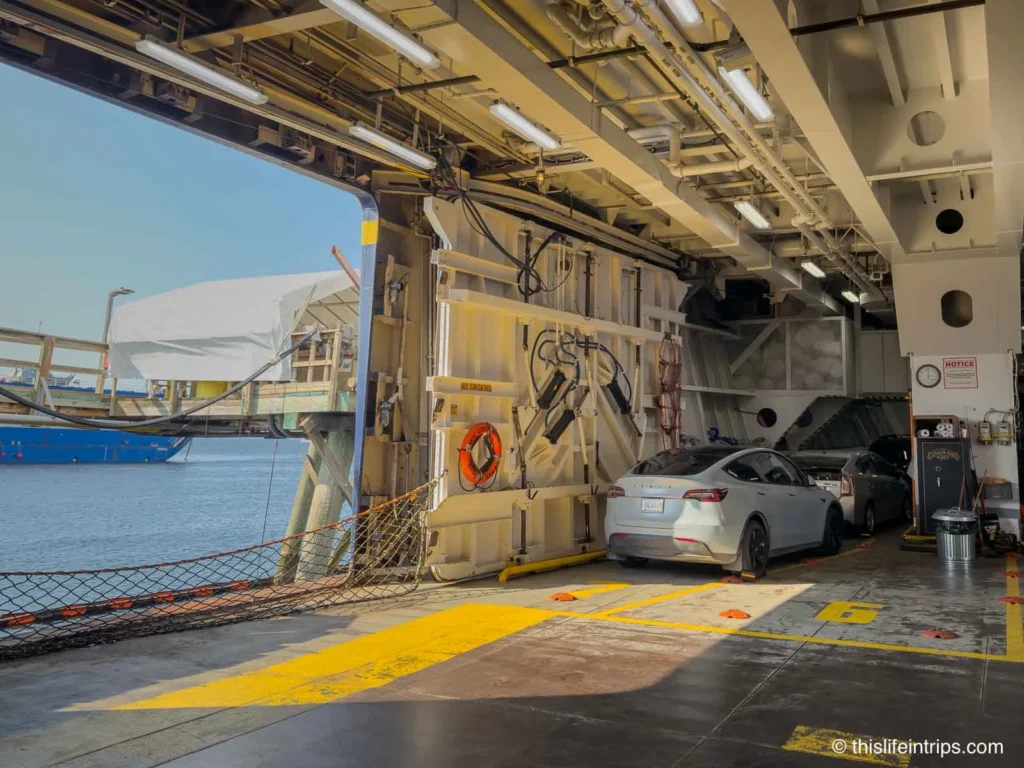
The car essentially became a floating basecamp. I’d highly recommend others do the same — stock your vehicle well with supplies and gear you might want, because the ferry can feel like an unplugged retreat.
I spent long stretches just walking the decks, chatting with fellow travelers, and soaking in the surreal landscapes of the British Columbia and Southeast Alaska coastlines.
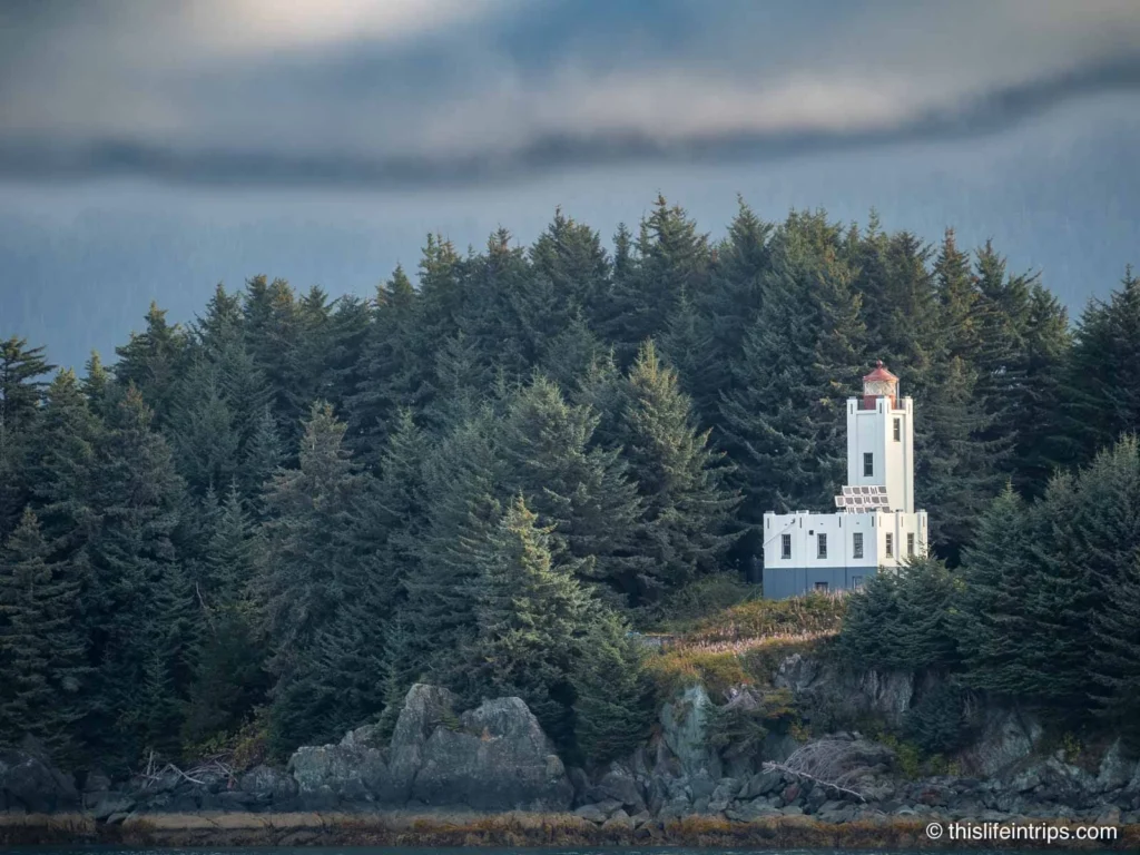
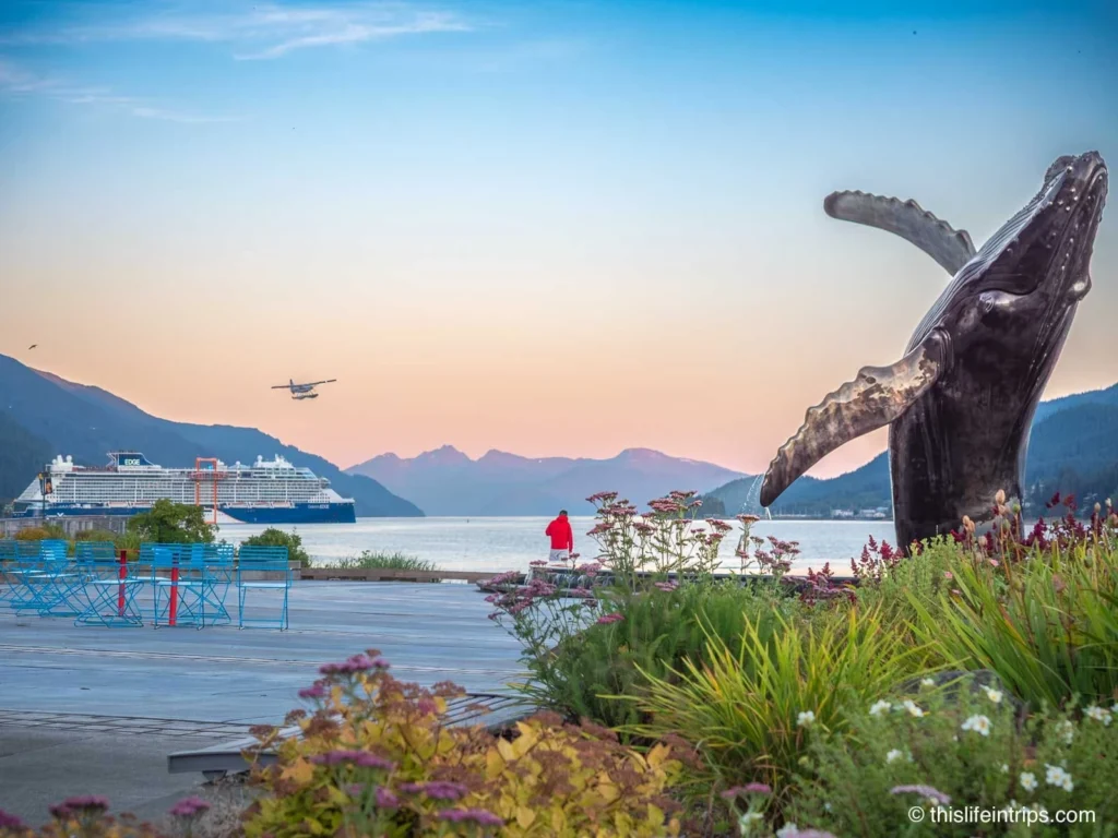
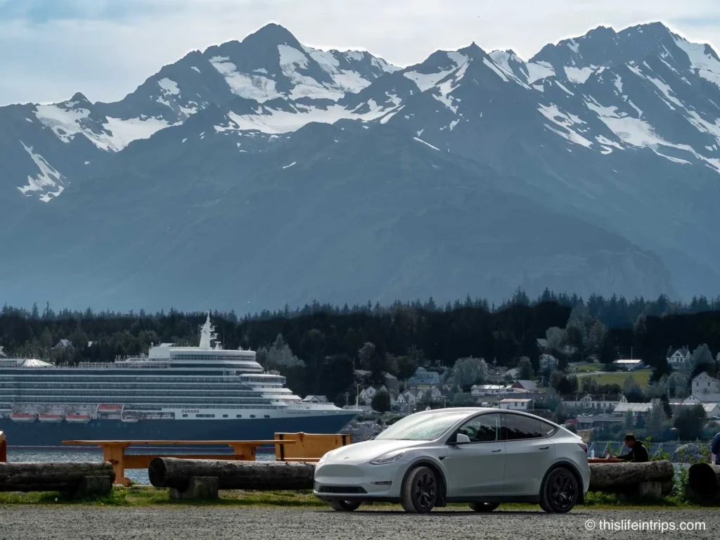
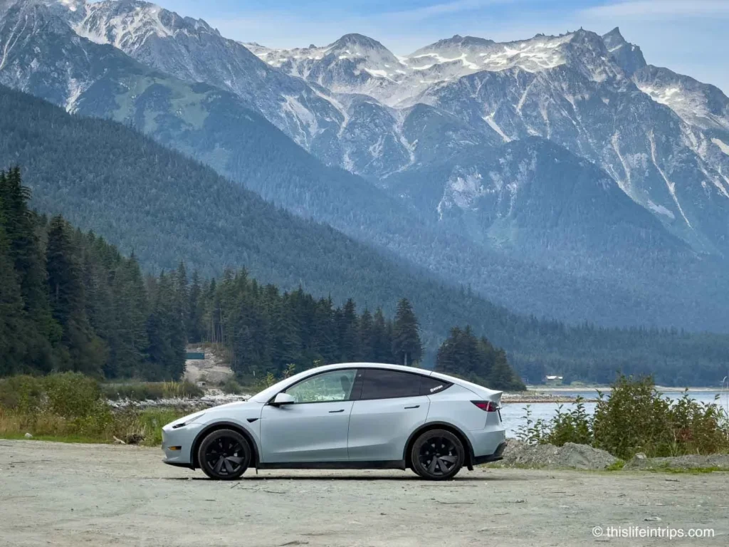
Juneau, Alaska
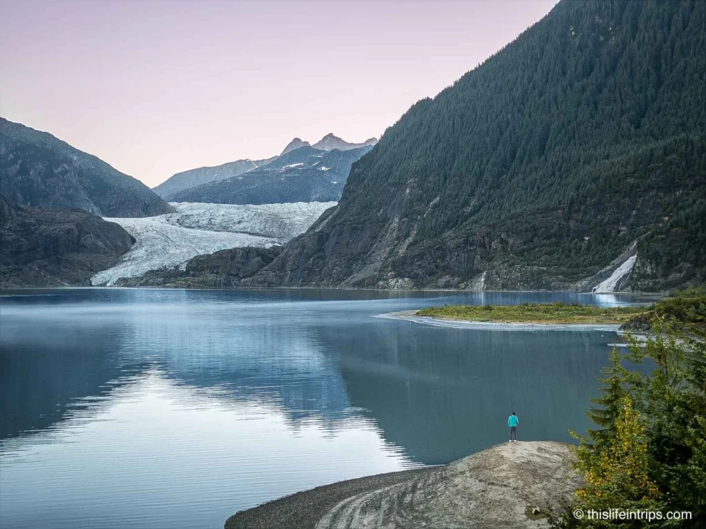
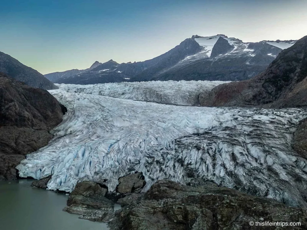
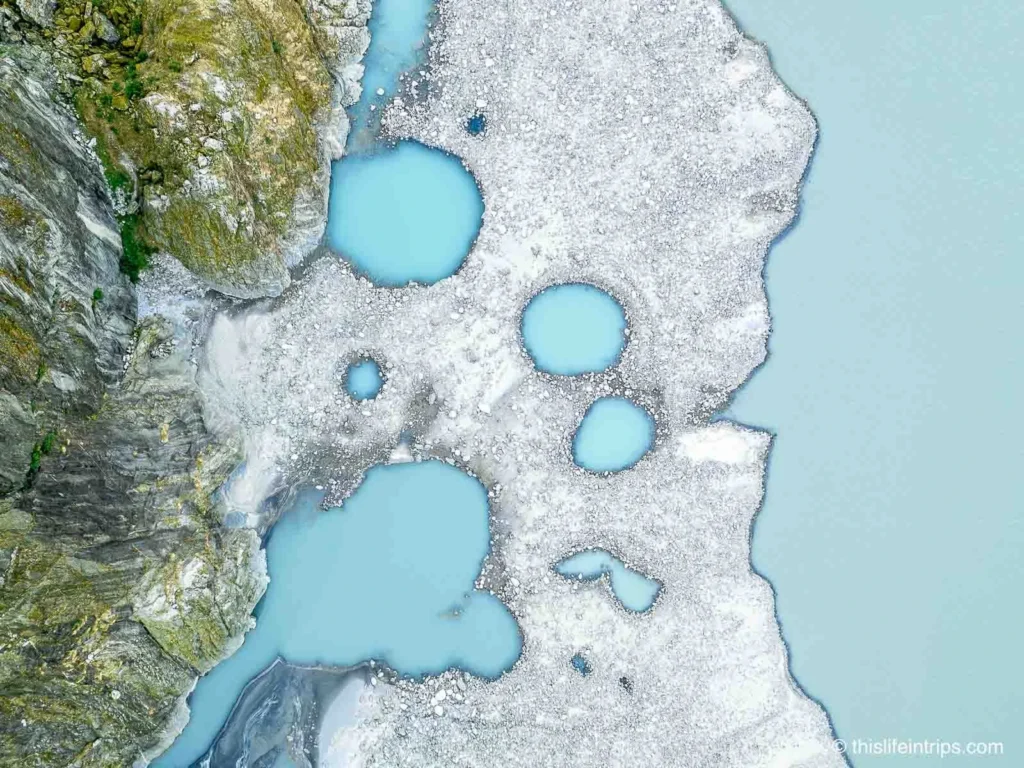
Upon arriving in Juneau at 4:00 AM, I found a free Level 2 charger at the University of Alaska and caught a nap while topping up. At sunrise, I visited the famous Mendenhall Glacier — alone, quiet, and simply magical.
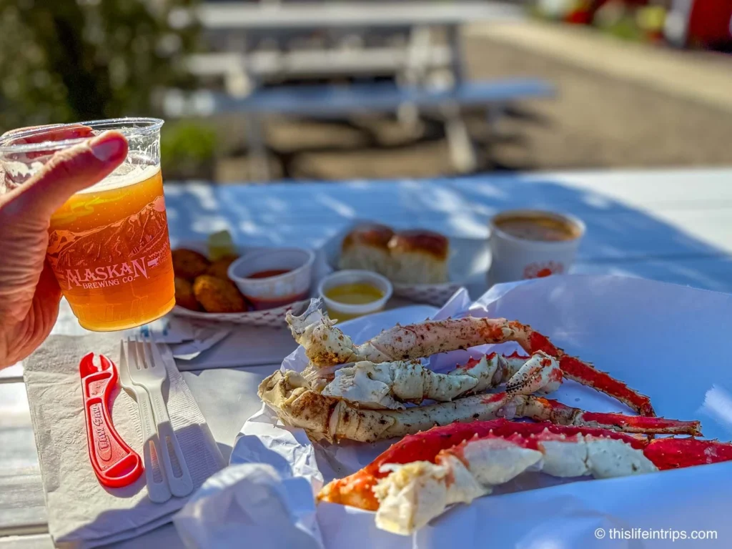
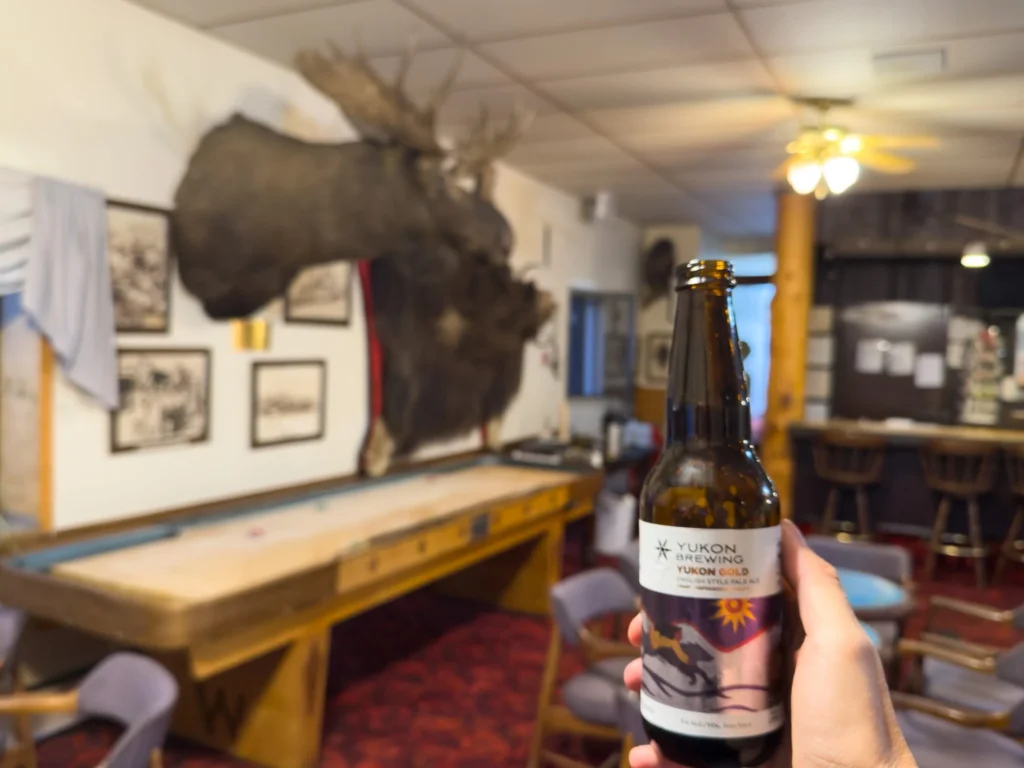
After a quick recharge and a bike ride around Auke Lake, I visited the Alaska Brewing Company, where they had a free CHAdeMO fast charger. Good thing I kept and packed my CHAdeMO adapter. I hit 90% while enjoying a beer flight and some sunshine on their back deck.
After touring the city and feasting on a crab dinner, I called it a night at my downtown hotel. Although it was a great spot to explore the city from, in retrospect, I would recommend staying closer to the ferry terminal to take out some of the drive in the early AM.
The next ferry to Haines was short but packed with more unreal views. Seriously one of the most scenic boat rides I have ever enjoyed.
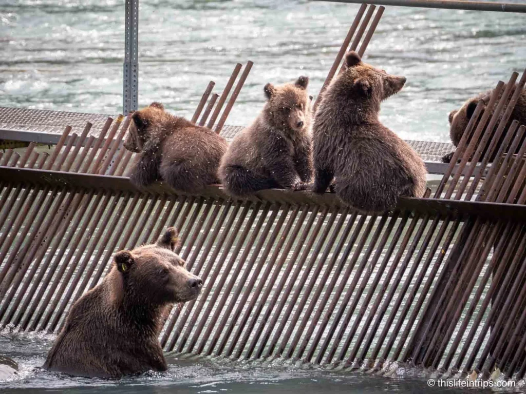
I landed with plenty of charge to get to Haines Junction, the longest no-charger stretch of this leg, but I made a detour to Chilkoot Lake for some bear watching. I lucked out with an epic scene: a mama bear and her four cubs feasting on salmon.
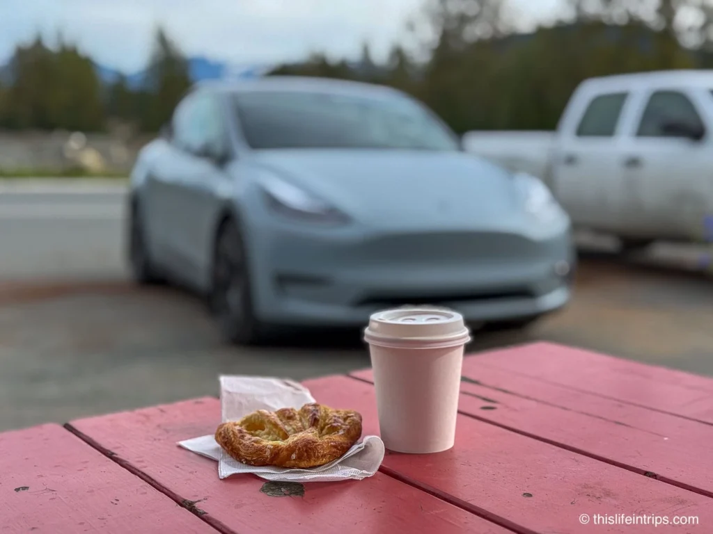
I then biked to Chilkoot Lake to take in the views, which did not disappoint. On the way out of town, I stopped at Mountain Market & Cafe and picked up some excellent baked goods and coffee.
The reason I went the long way to the Yukon through Haines rather than Skagway was because my friend, photographer Aaron Von Hagen, swore the drive was worth it—and he was absolutely right.
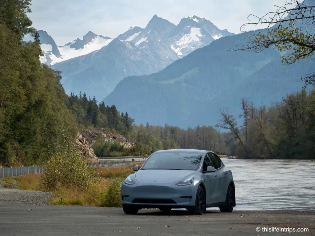
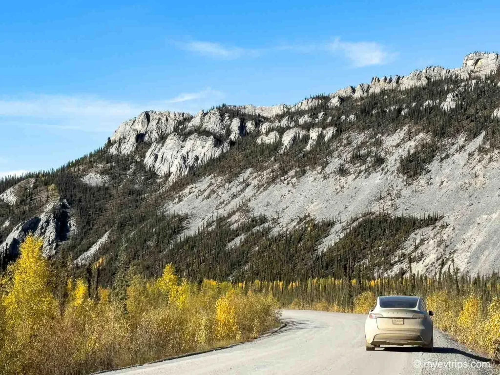
The route follows the scenic Haines Highway, winding through the Chilkat Valley with towering peaks on both sides, and climbing past highlights like the Three Guardsmen Mountain viewpoint, Tatshenshini-Alsek lookouts, and the Haines Highway Summit (1,070 m / 3,510 ft), where the road opens to sweeping views of alpine tundra and distant glaciers.
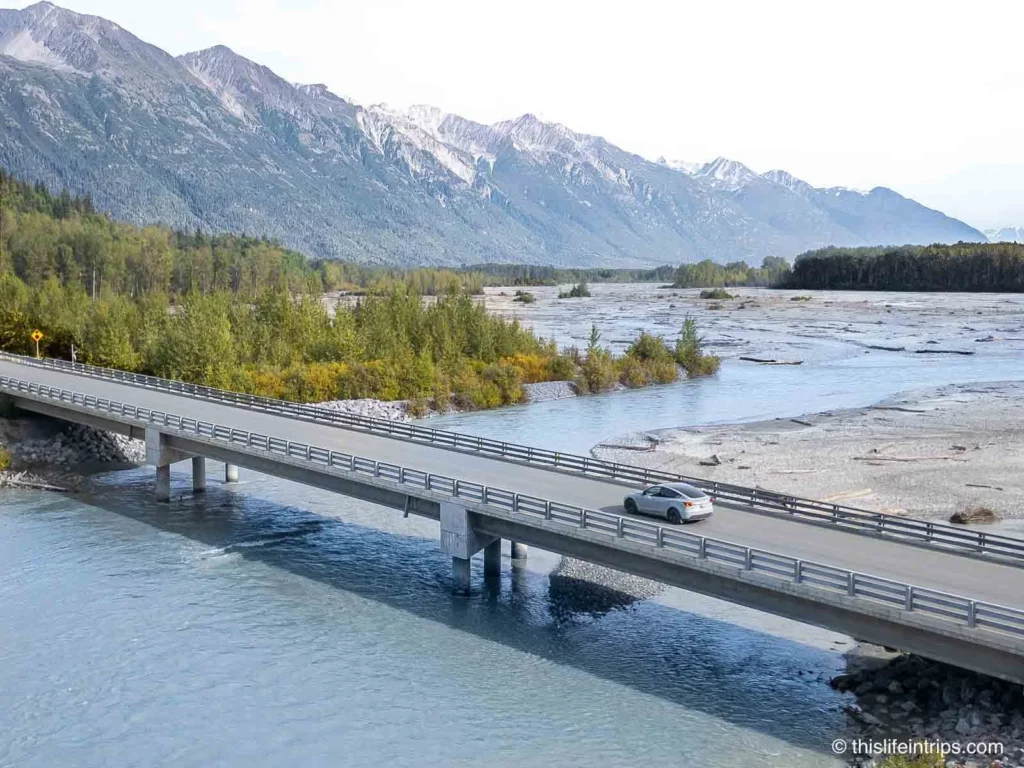
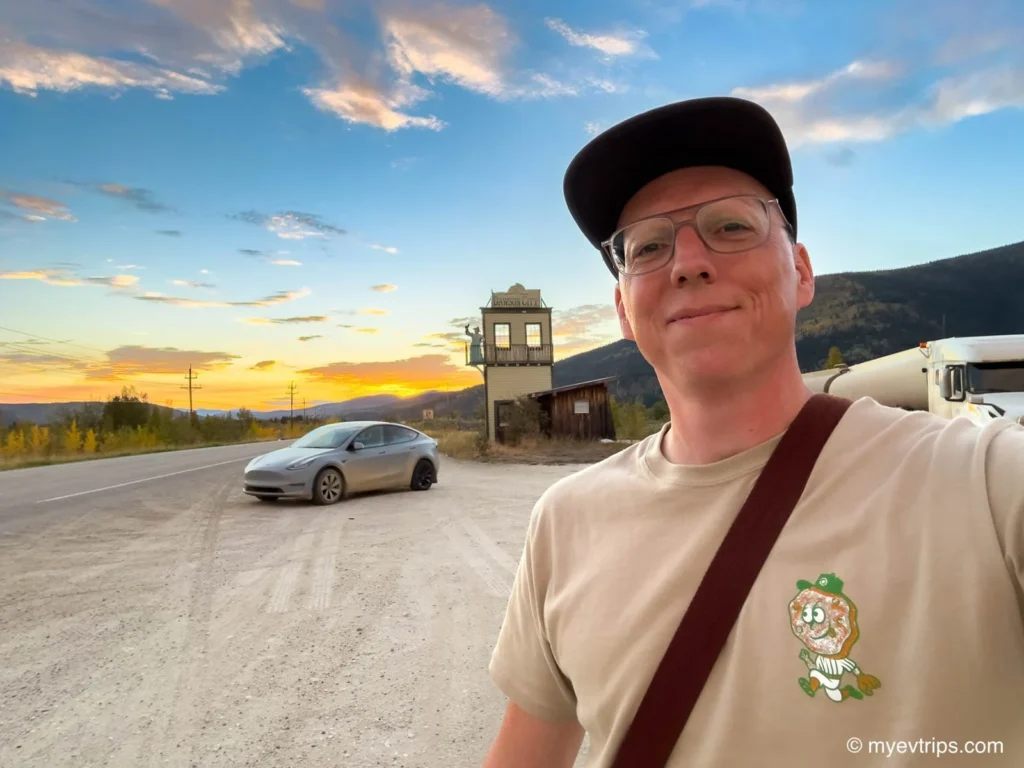
By the time I reached Haines Junction, I was still buzzing from the scenery. I checked into the Stardust Motel, where I met up with Aaron—who was driving an ICE vehicle and would be my backup plan if the Dempster didn’t play nice with an EV. Having a buddy (and a talented photographer) along made the push north a lot easier.
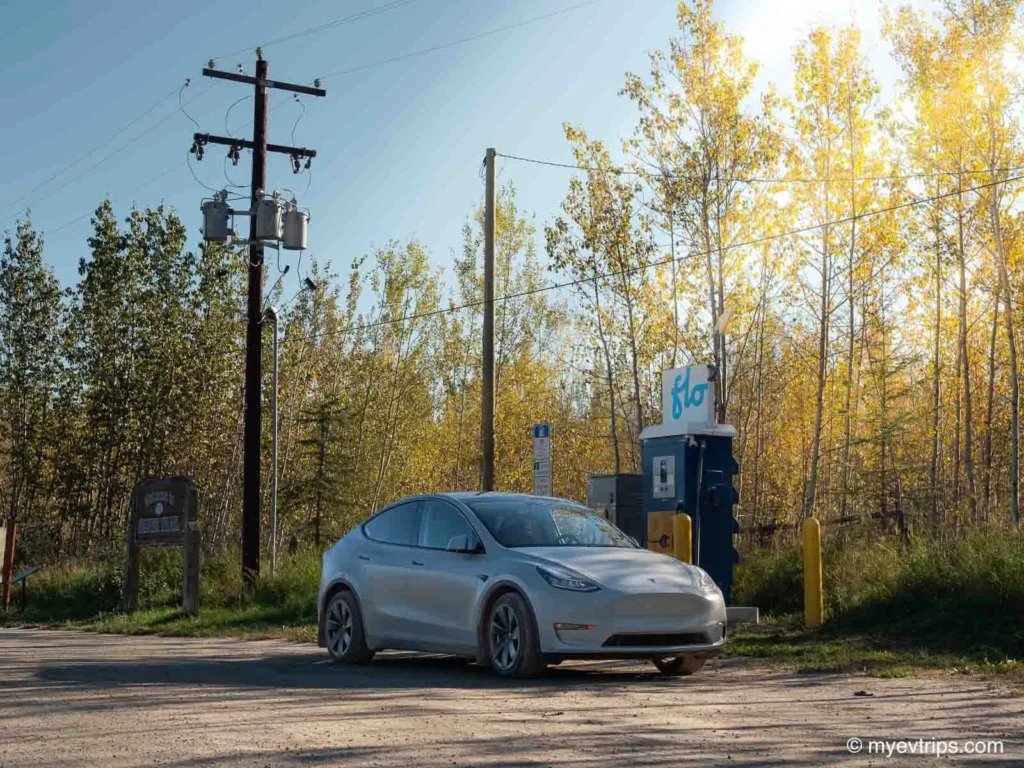
The motel didn’t have charging, but there was a free L3 Flo charger at the visitor center, so I topped up there before returning to the motel for a catch-up with Aaron and had an exciting chat on what was to come.
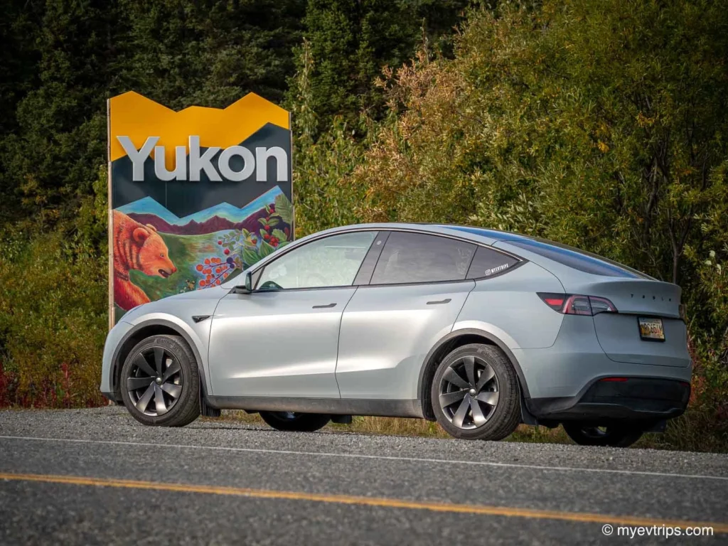
Leg 2: Haines Junction to Dawson City
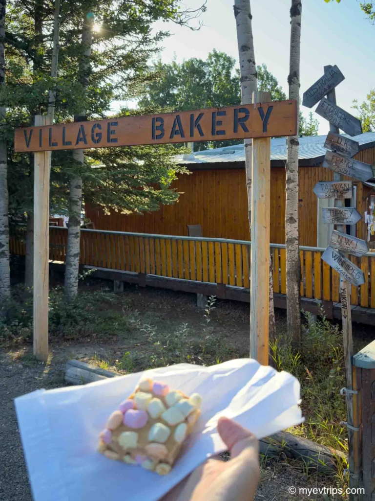
After stocking up on baked goods and coffee at the amazing Village Bakery, I left Haines Junction with a 95% charge in a convoy with my travel buddy.
Yukon is well equipped with L3 chargers along the highway (although mainly only 1 at each stop), so I was comfortable skipping one if it was in use.
That said, I accidentally bypassed the charger in Mendenhall (I punched in Mendenhall Landing) and rolled into Carmacks with very little battery. Thankfully, the fast charger was available.
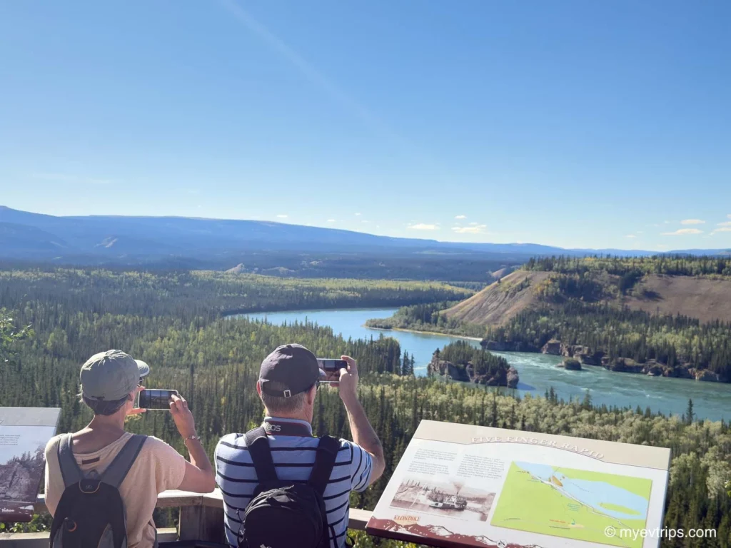
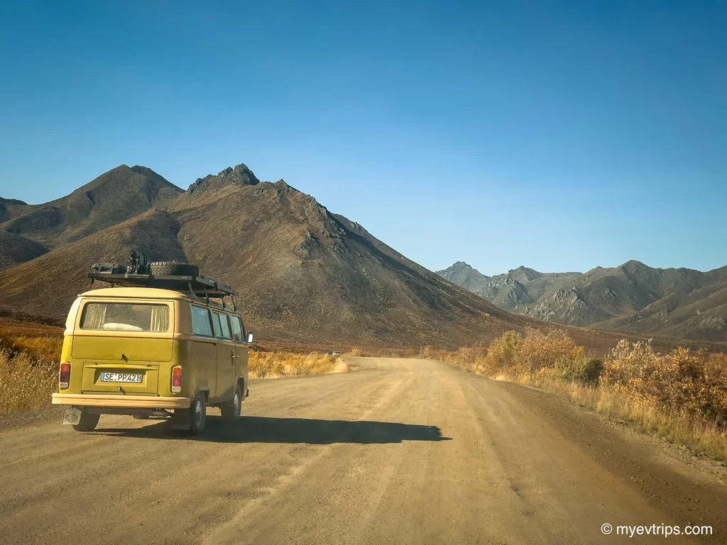
After Carmacks, I stopped at Five Finger Rapids and started seeing heavily outfitted pickup trucks and adventure vans everywhere — a preview of the rugged road ahead, which made me second-guess my decision to tackle the Dempster Highway in an EV.
Was I underdressed for this party?
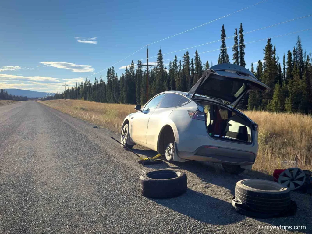
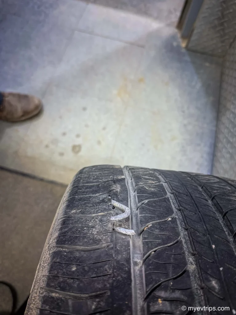
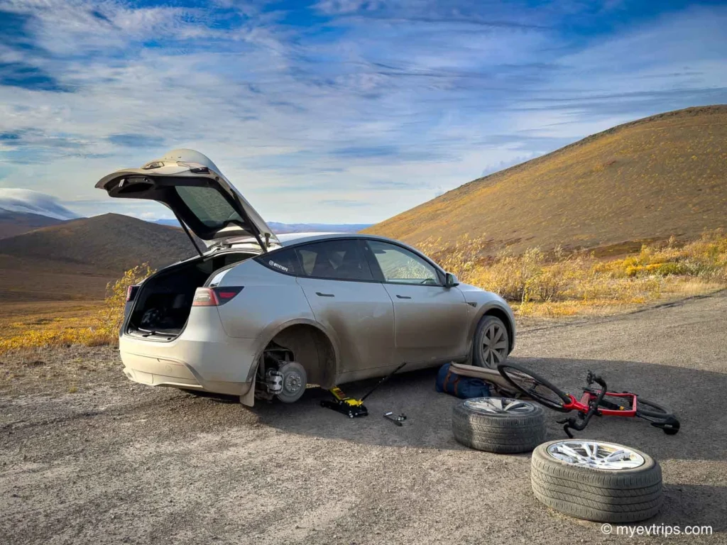
This nervousness came with a gut punch a little while later: a flat tire before even reaching the Dempster Highway. This rattled me.
I knew sharp shale on the Dempster is a tire killer, and here I was down a spare already. This added anxiety about range and terrain and left me scrambling to get the tire patched the next day.
Thanks to the flat, I was behind schedule getting into Dawson City — and late for my fantasy football draft. Thankfully, Starlink in my Model Y (and FSD) let me monitor picks on the go, a modern luxury in one of the most remote corners of the Yukon. We truly live in the best time 🙂
I’d planned to top up at the newly installed FLO charger at the Dempster Highway turnoff the next day before heading north, but it wasn’t online yet (see my Dempster Highway Plan post for details).
I called the Bonanza RV campground, as I swear it listed 50-amp service, hoping to squeeze out a little extra range before tackling the Dempster — especially since I was now driving on one of my spare winter tires. It would only save me about 5 Km but every kilometre mattered if I wanted to make it to Eagle Plains without issue.
They confirmed they had 50A service and availability so I decided to stop in. As I rolled into town, I spotted a Rivian behind me — a rare sight this far north — and realized I might be competing for the same lone L3 charger in town. I debated heading straight to Dawson, but gambled on the campground instead.
True to northern form, the “Open” sign glowed but the office was locked tight (a theme that continued through the trip), and the sites only had 30A service. I turned back toward town, and sure enough, the fast charger was occupied.
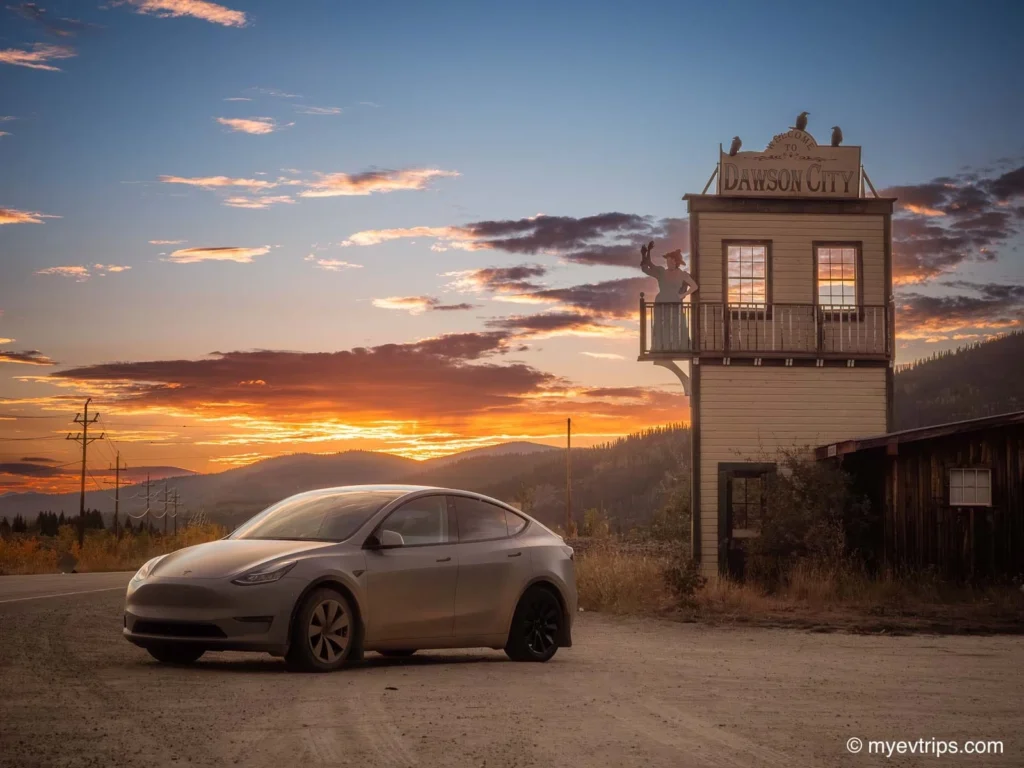
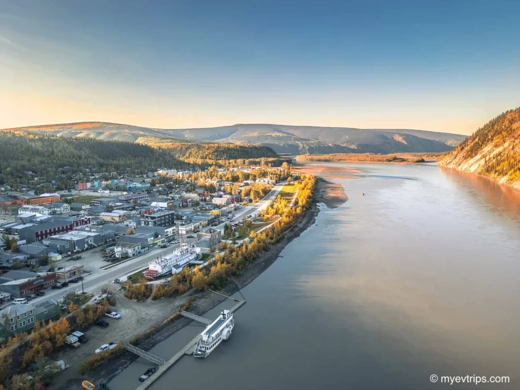
Thankfully, I remembered a 50A plug listed on PlugShare, tucked beside a public gazebo just a block and a half from my Downtown Dawson City hotel. It wasn’t glamorous, but it worked perfectly for an overnight top-up.
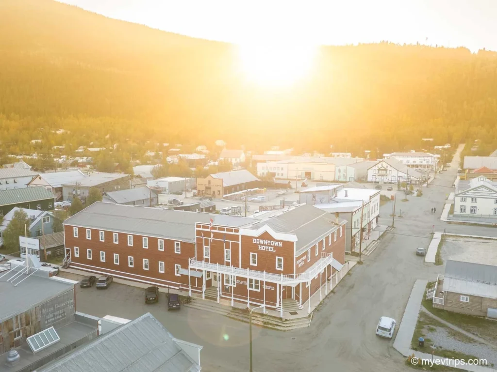
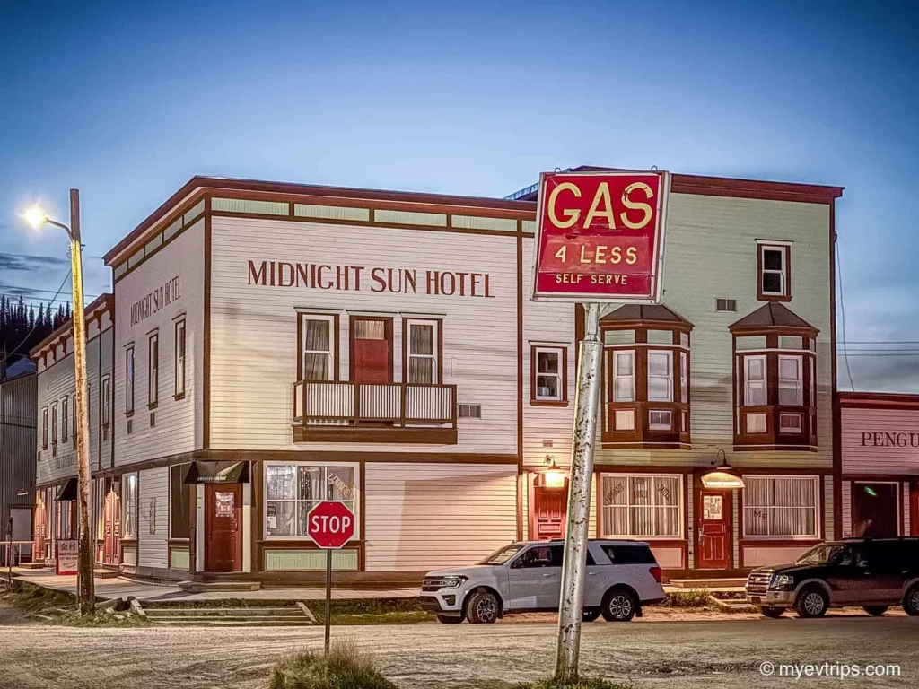
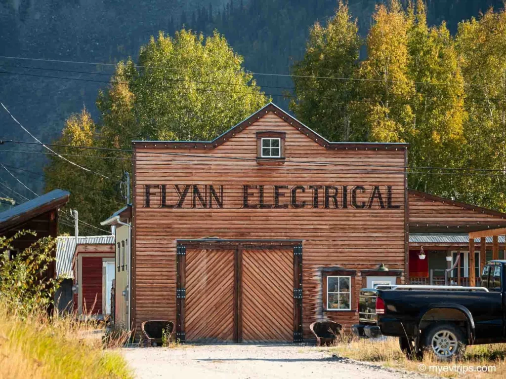
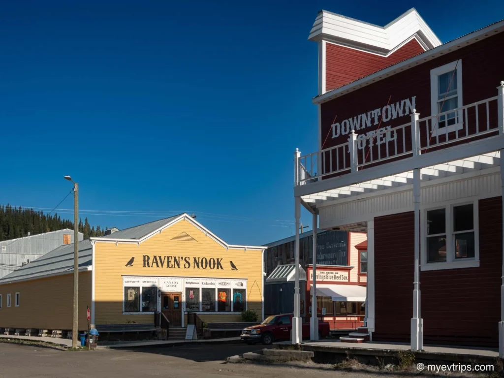
The Downtown Hotel — my home for the night — couldn’t have been better located. It’s close to both chargers, has comfortable and modern rooms and, of course, home to Dawson’s infamous Sourtoe Cocktail (more on that later).
After checking in and grabbing a hot shower, I met up with Aaron to debrief and plan the next leg.
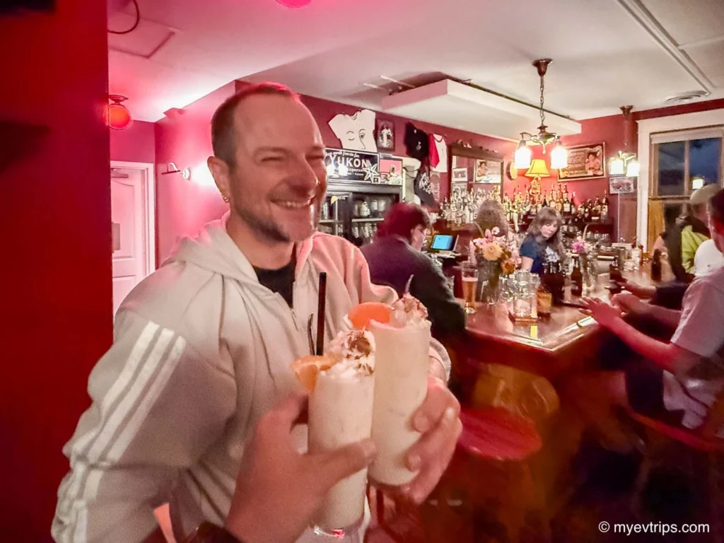
The night ended in true Dawson City fashion — the power went out at the bar we were at, candles were lit, and someone started playing old-time tunes on the piano. After a day of flat tires, range anxiety, and northern improvising, it was the perfect way to end it.
Leg 3: Dawson City to Eagle Plains
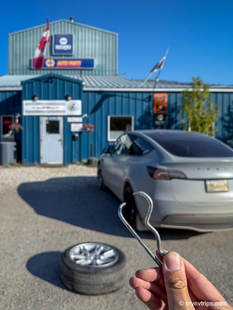
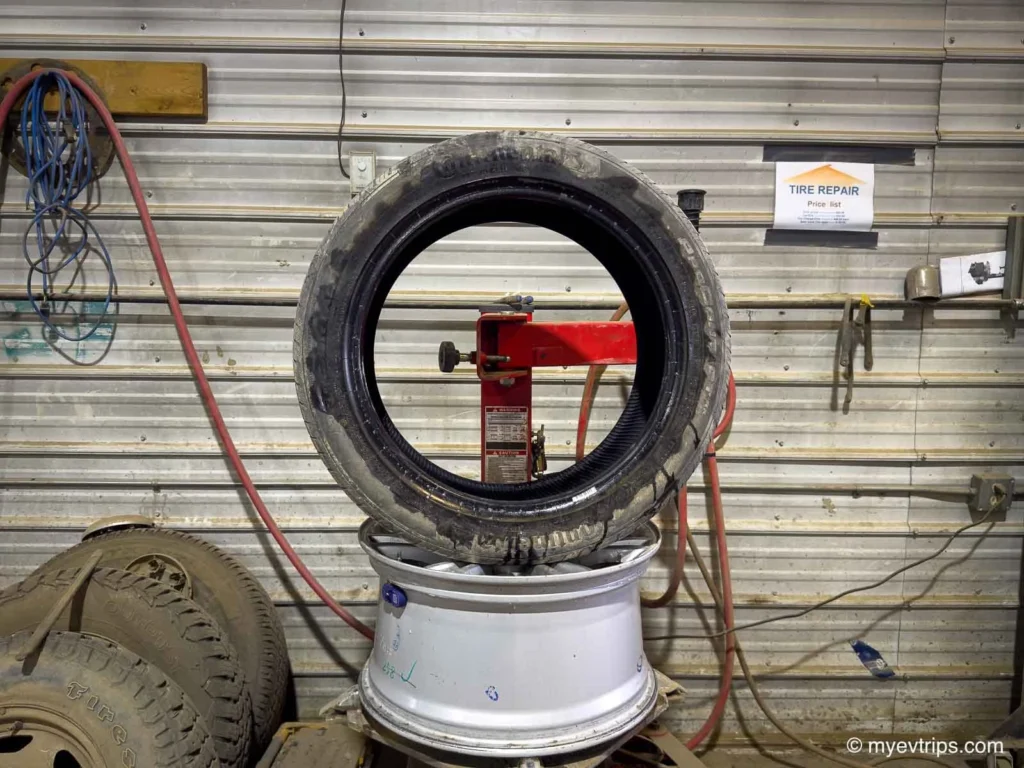
The first order of business before the long day ahead was to get the tire sorted. I dropped it off early, hoping it could be patched—it turned out to be a trailer pin split in two, and I had my doubts.
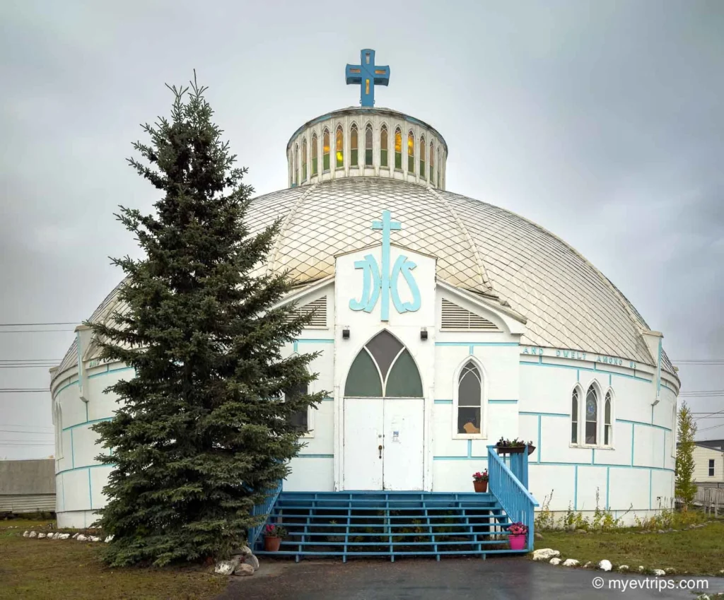
The repair gave me some time to kill. Thankfully, it was a beautiful morning in Dawson City, so I grabbed a coffee, wandered the quiet streets, and took in a bit of the town’s unique charm while my Model Y topped up to 100%.
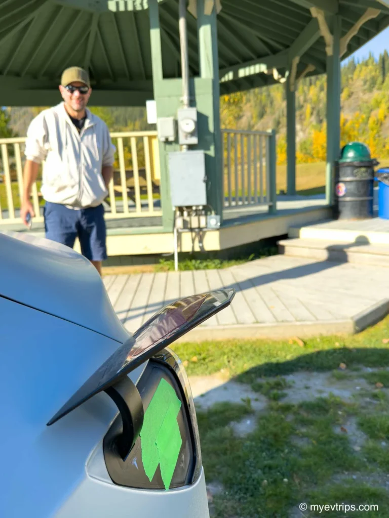
I also took this time to tape up my charge port for the long, dusty road ahead.
After a couple of anxious hours, I got a call with good news — the tire was patched and ready to pick up. I grabbed it, loaded everything back in, and pointed north toward the Dempster Highway.
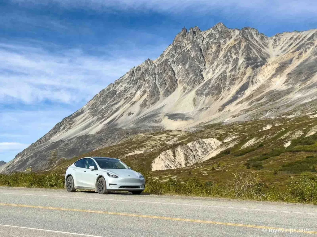
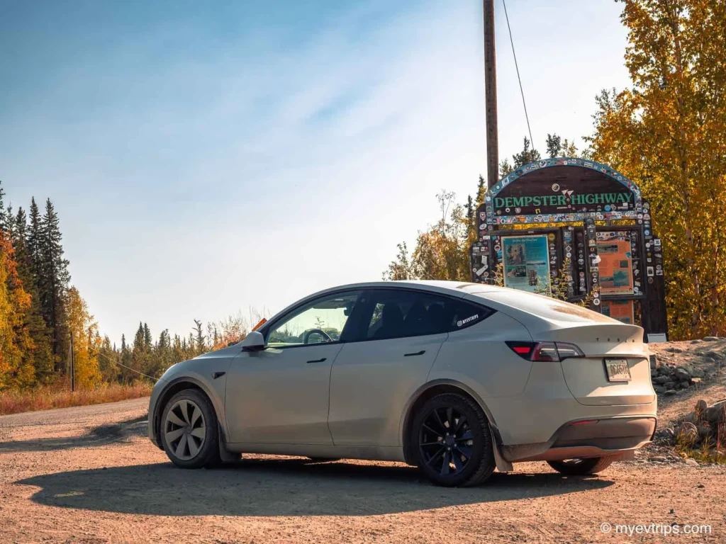
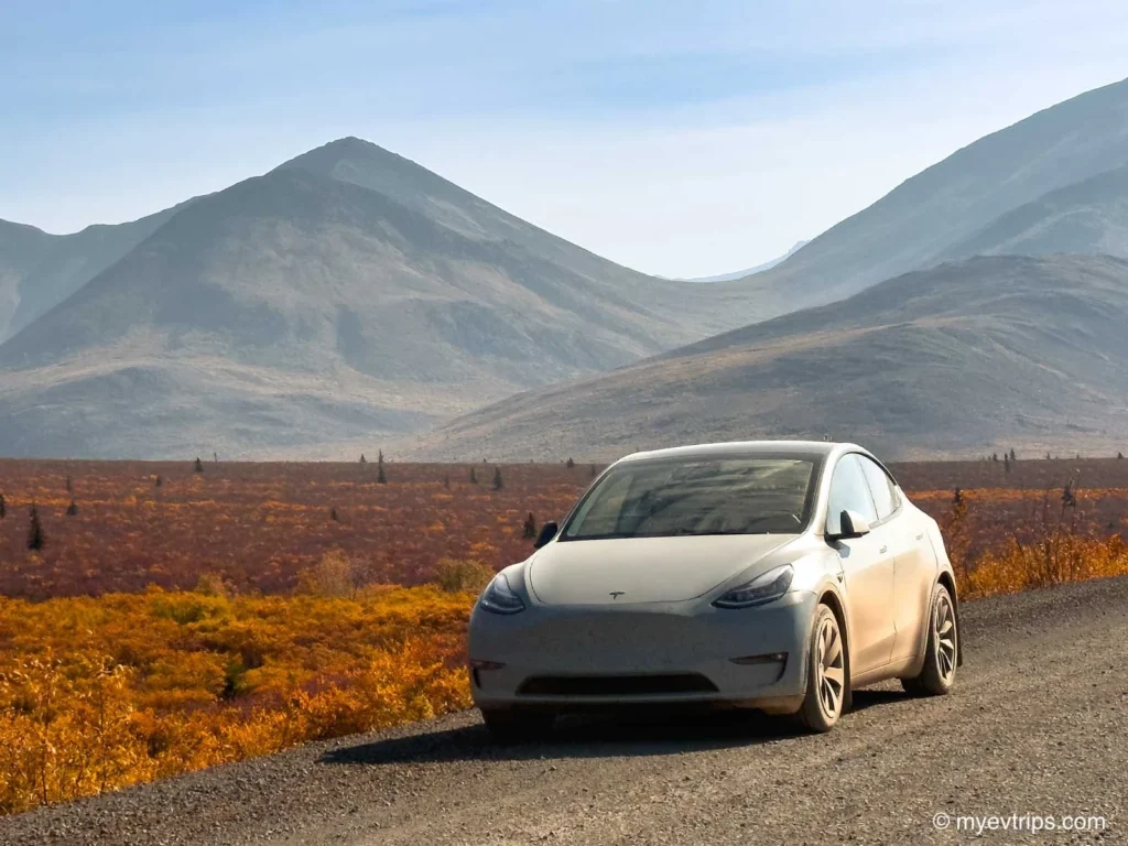
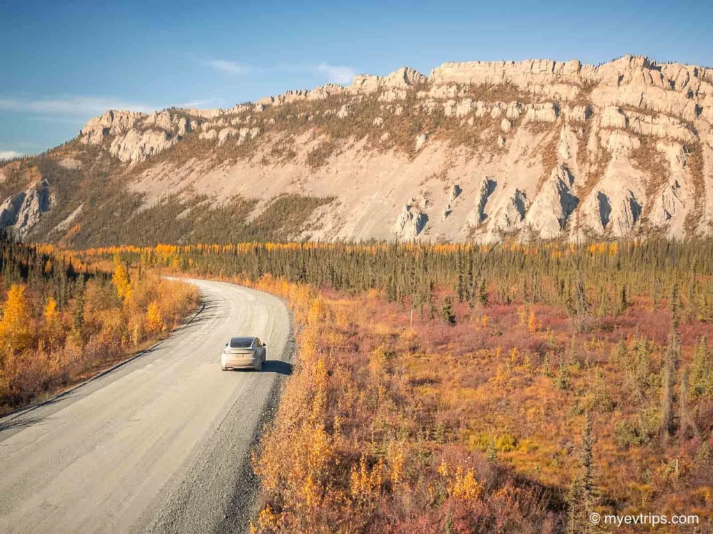
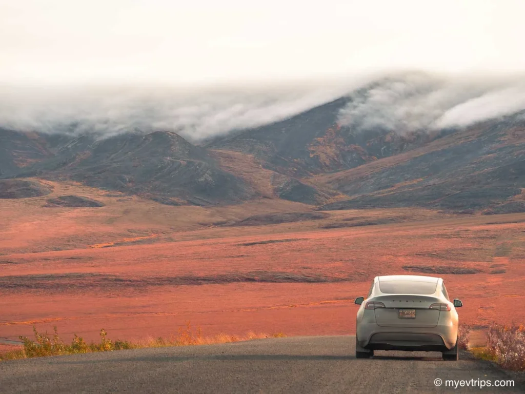
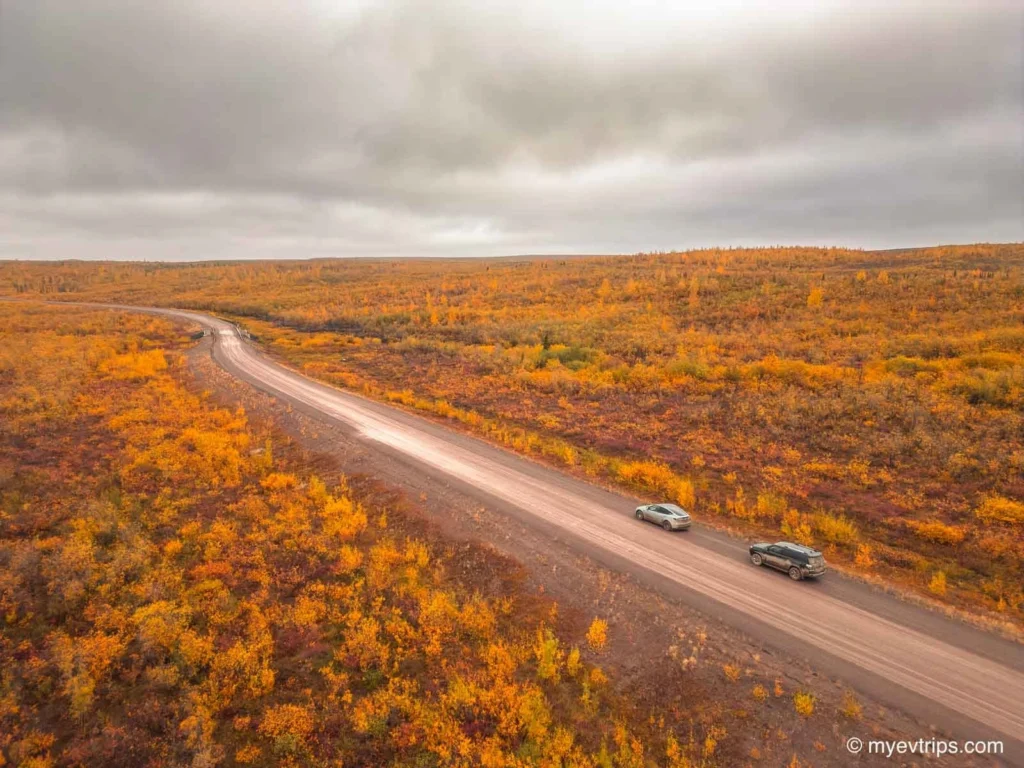
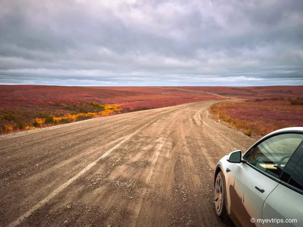
I crawled at about 50 km/h the 40 km to the start of the Dempster Highway. I was watching my range nervously — this was the longest leg yet: 409 km (254 mi) to Eagle Plains with no charging in between. My recent battery health check showed more degradation that I had hoped, leaving me with only 465 Km of range. Bad weather or any other suprises could be a problem.
I started off with an estimated 4% remaining but bumped that up to 15% by driving slowly to the Dempster turnoff.
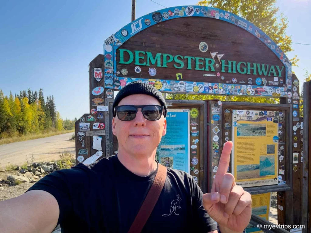
Then I made a boneheaded move: after stopping at the turn off sign for a photo, I forgot my stickers at the Dempster sign and backtracked 10 km to get them. That erased my buffer entirely. ????♂️
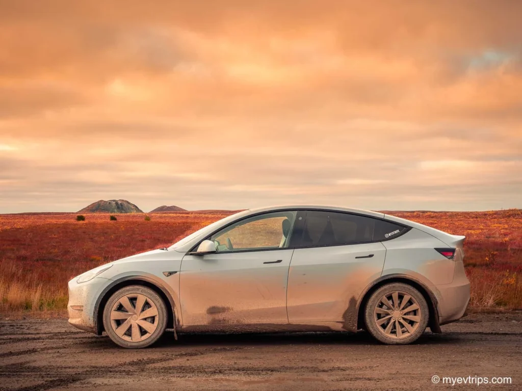
If that wasn’t bad enough, within 15 minutes of being on the Dempster I took my first rock chip—dead center on the driver’s side. Like the flat tire, I knew it was inevitable, just not this early in the trip.
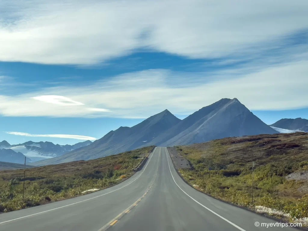
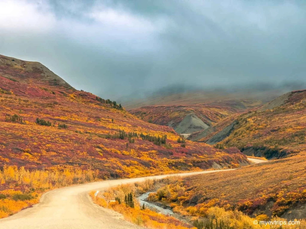
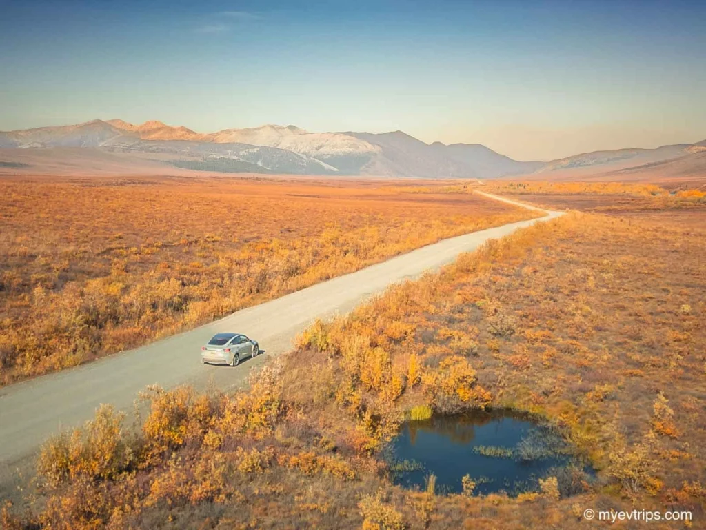
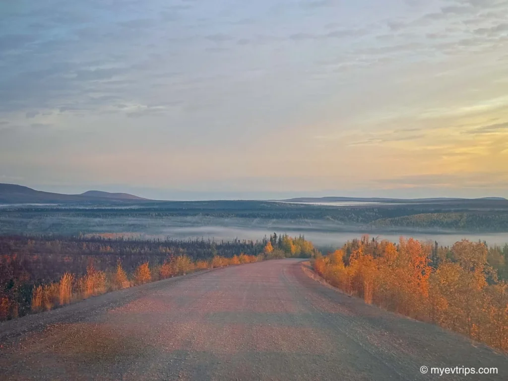
Through Tombstone Territorial Park
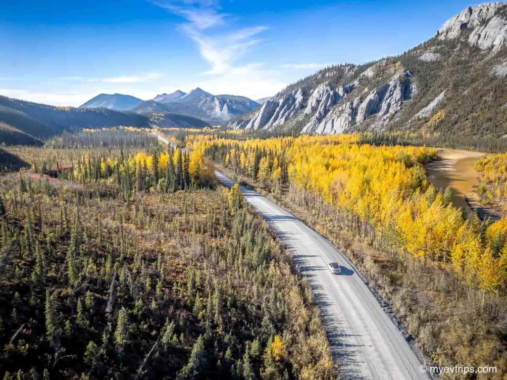
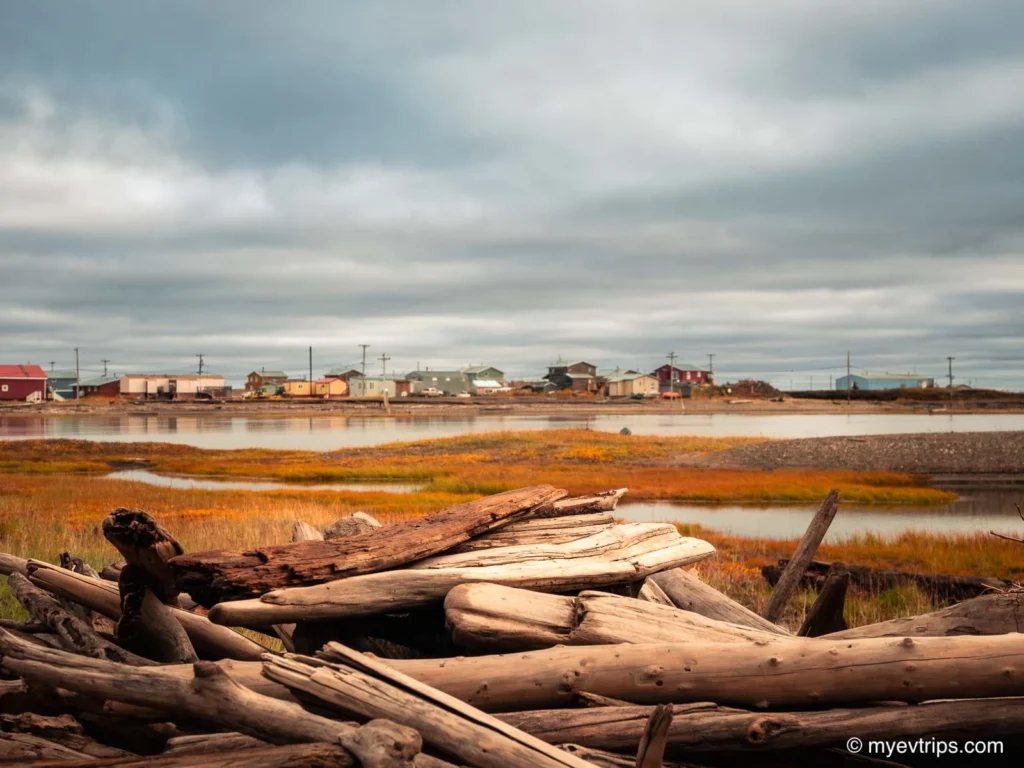
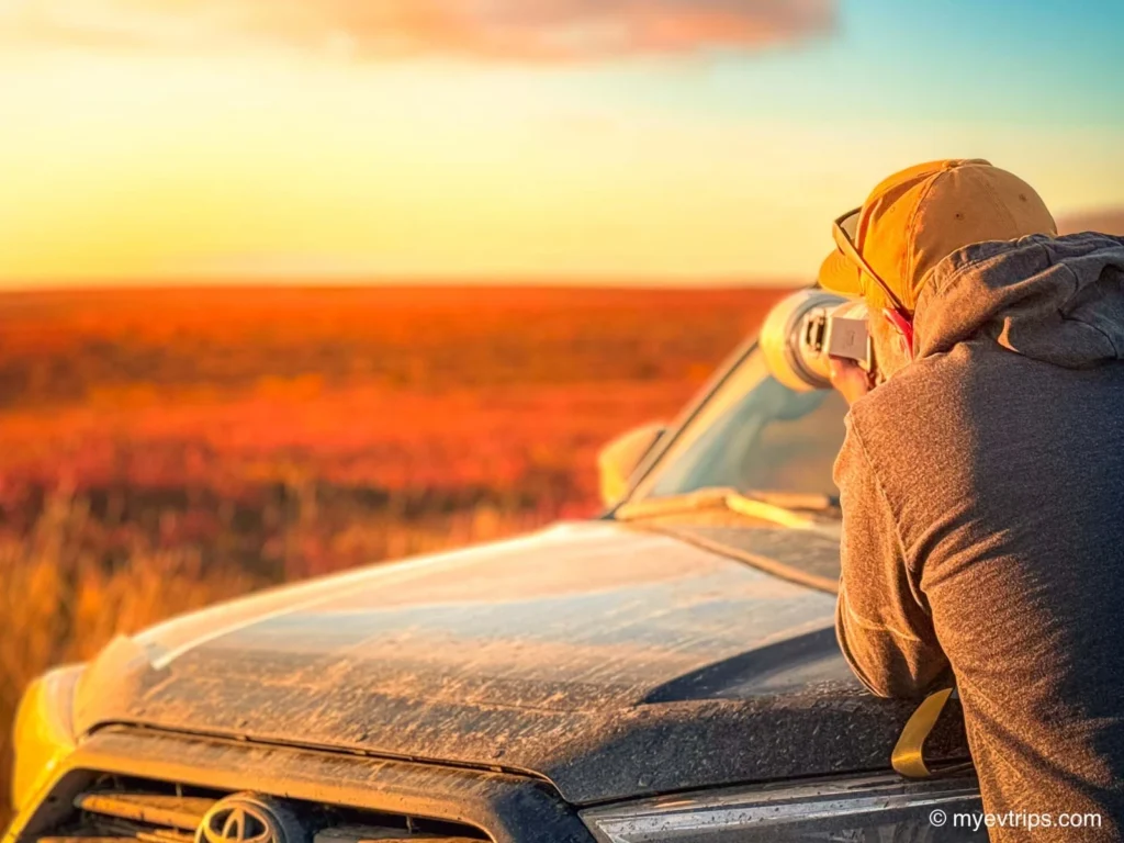
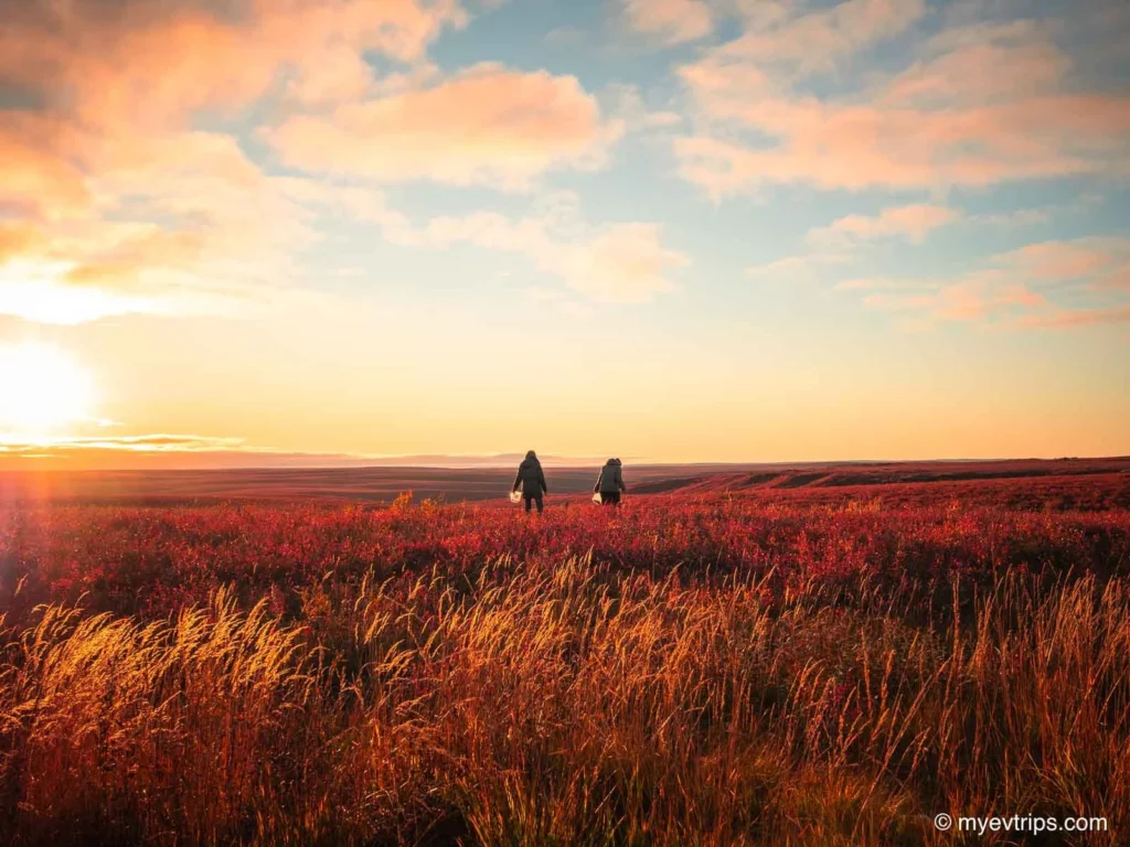
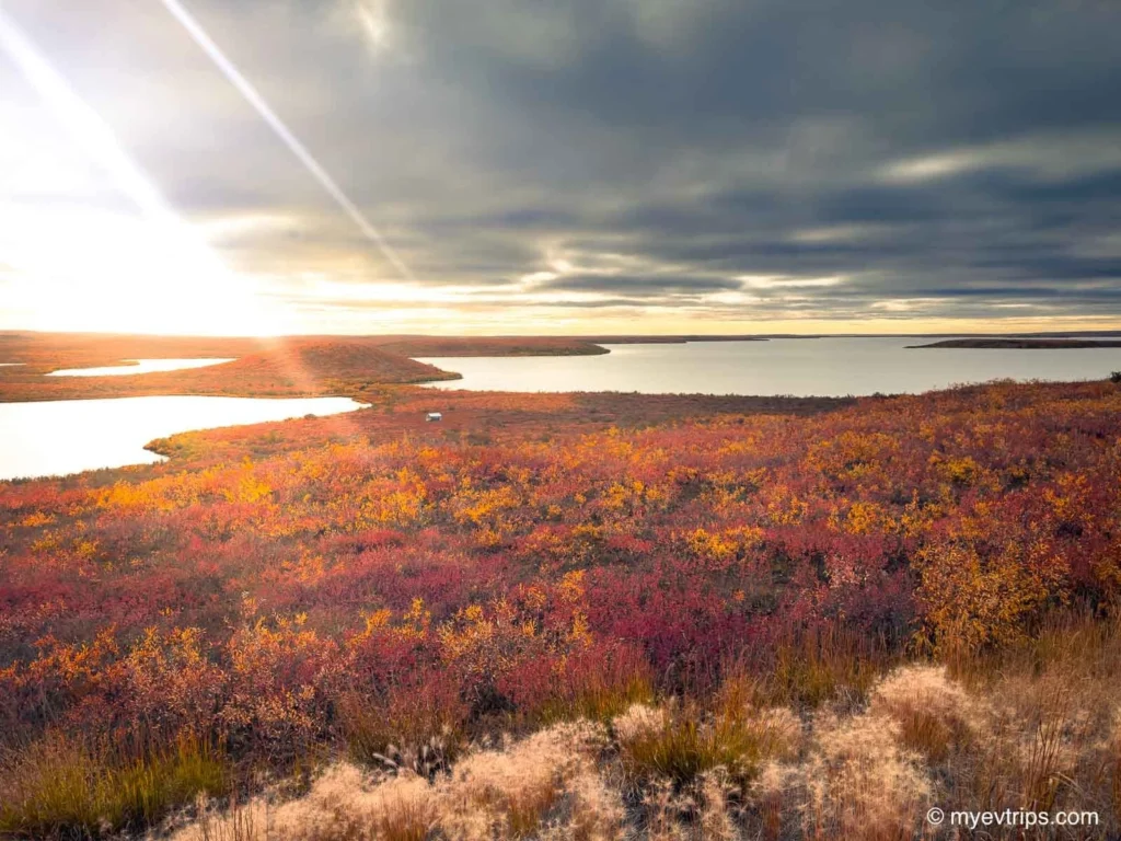
Fall colours through Tombstone Park Yukon were at their peak. Reds, oranges, and golds surrounded me, and every bend had another epic view. Tombstone Provincial Park might just be the most scenic stretch of the Dempster Highway Yukon, and I was there for it. Every turn brought something new.
I passed several tempting Dempster Highway campgrounds and daydreamed about spending the night to enjoy the views a little more. With that looming battery percentage and a patched spare, this wasn’t an option. I had to reach Eagle Plains.
It was a long, slow day, but I rolled into Eagle Plains with just 4% (17 km remaining). The buffer I’d built into the day came and went as I adjusted my speed, keeping it mostly under 60 km/h to be safe — and it turned out that was absolutely necessary.
Thankfully, charging was straightforward now that the donated Tesla destination charger at Eagle Plains was finally online. I had worked with a Cybertruck owner ahead of time to help get it running, and they discovered the issue was simply an over-tightened faceplate. A quick fix — but one I was very glad was sorted before my arrival.
At Eagle Plains, I reconnected with my travel partner and we debriefed in the quirky yet wonderful lounge at this truck stop in the middle of nowhere.
We were able to book a room at the Eagle Plains Motel for the night and, although not glamorous, it was much better than what I did on my return. More on that later.
Leg 4: Eagle Plains to Inuvik
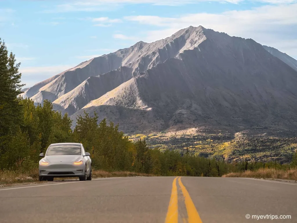
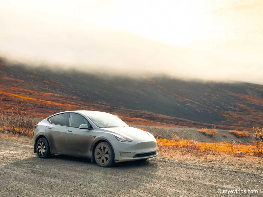
I started the day feeling on top of the world — fitting, since we were heading north toward the actual top of the world. The morning light leaving Eagle Plains was incredible, with low clouds and soft sun spilling across the tundra.
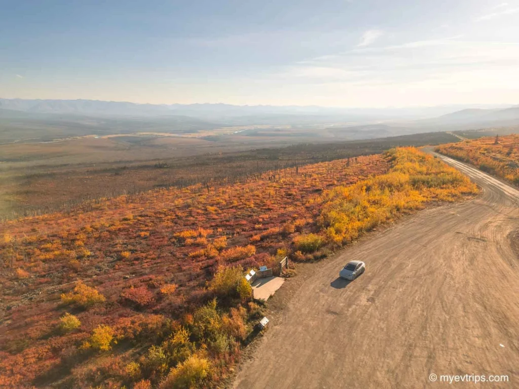
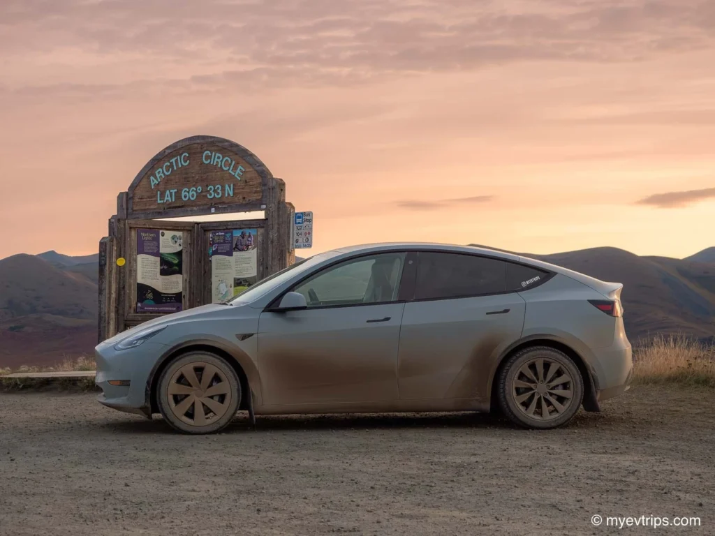
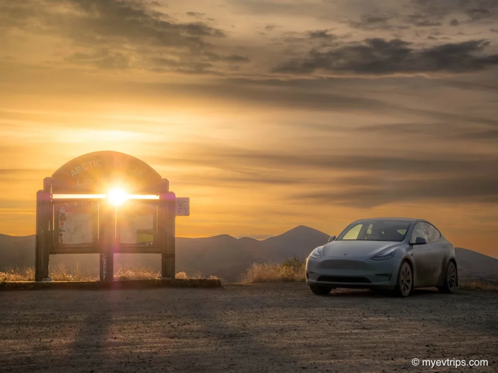
We stopped at the Arctic Circle sign to take it in and make a coffee. It felt like such an accomplishment, but there was still a long ways to go. Still, it was a small moment of calm before what would turn into another long day on the Dempster.
About 25 minutes later, that calm vanished. Sharp shale struck and I had my second flat of the trip. The patched tire from Dawson was now on the car, and I had to trust it to get me to Fort McPherson. My anxiety returned fast.
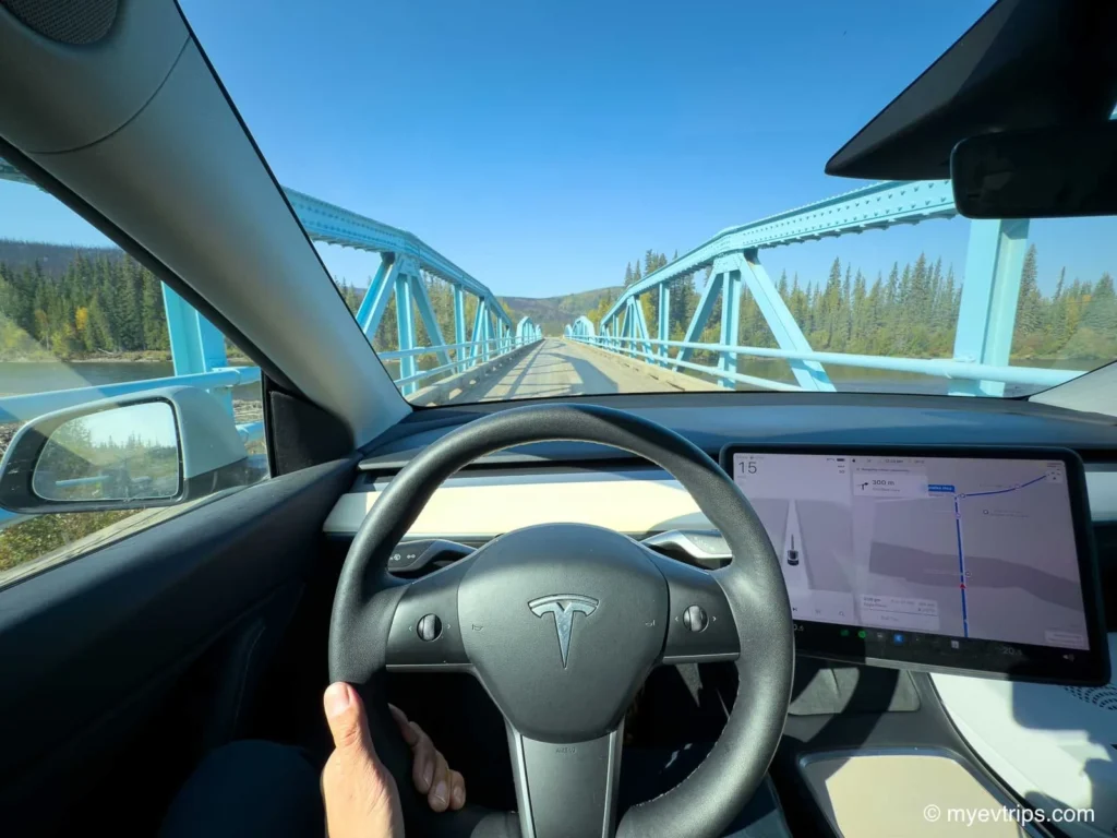
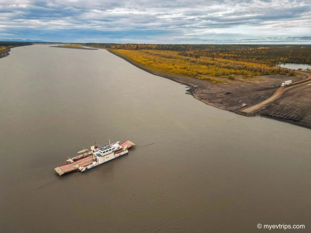
On top of that, the highway had taken a beating from recent rain. Mud was deep, traction was poor, and even slow turns felt sketchy. I kept the speed under 60 km/h and focused on getting through. Reaching the Peel River ferry felt like a small victory — in my interview with Patrick Nadeau he mentioned getting stuck there due to heavy rains, but the crossing went smoothly.
In Fort McPherson, I found a tire shop… permanently closed. Someone pointed me to LJ Contractors, which also had a 50A plug. Their outlet was a bit sketchy throwing faults and a reduced amps but it pulled enough power to give me a little peace of mind for the detour.
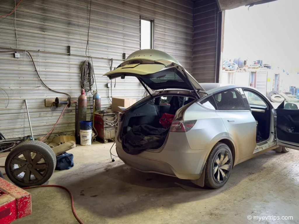
While charging, they patched the tire, though the staff member didn’t seem too confident, as it left a large bulge. That didn’t sit well with me. I limped cautiously to Inuvik, keeping speeds low in hopes I wouldn’t have to put it to the test.
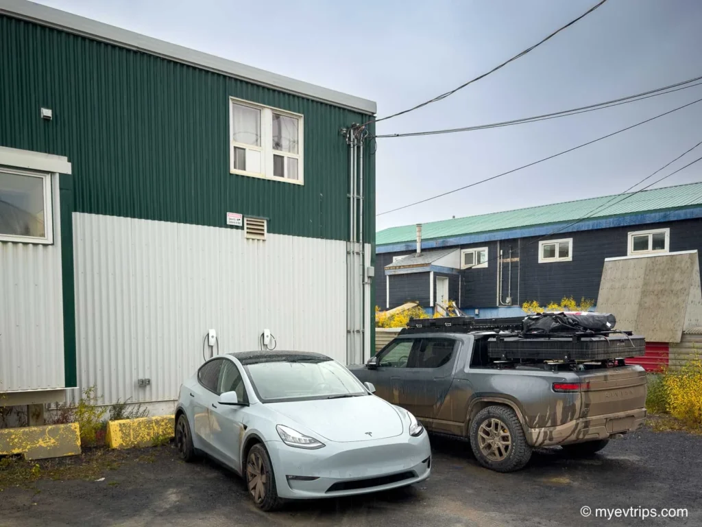
I arrived at Inuvik’s Arctic Char Suites safely and used one of two Tesla destination chargers. The other was used by a Rivian driver I’d been messaging with for weeks to coordinate charger use. That teamwork paid off to avoid any delays.
I didn’t end up staying at the Arctic Char Suites (I stayed at the Capital Suites down the street) as they were full but they let me charge there for $100. A steep price but electricity in the north is not cheap. It was a bit of a run around to ensure the chargers were turned on so be sure to call ahead if you are doing the same.
Another stressful day, but the fun wasn’t over yet. Although short, the last stretch to the Arctic Ocean proved to be challenging as well.
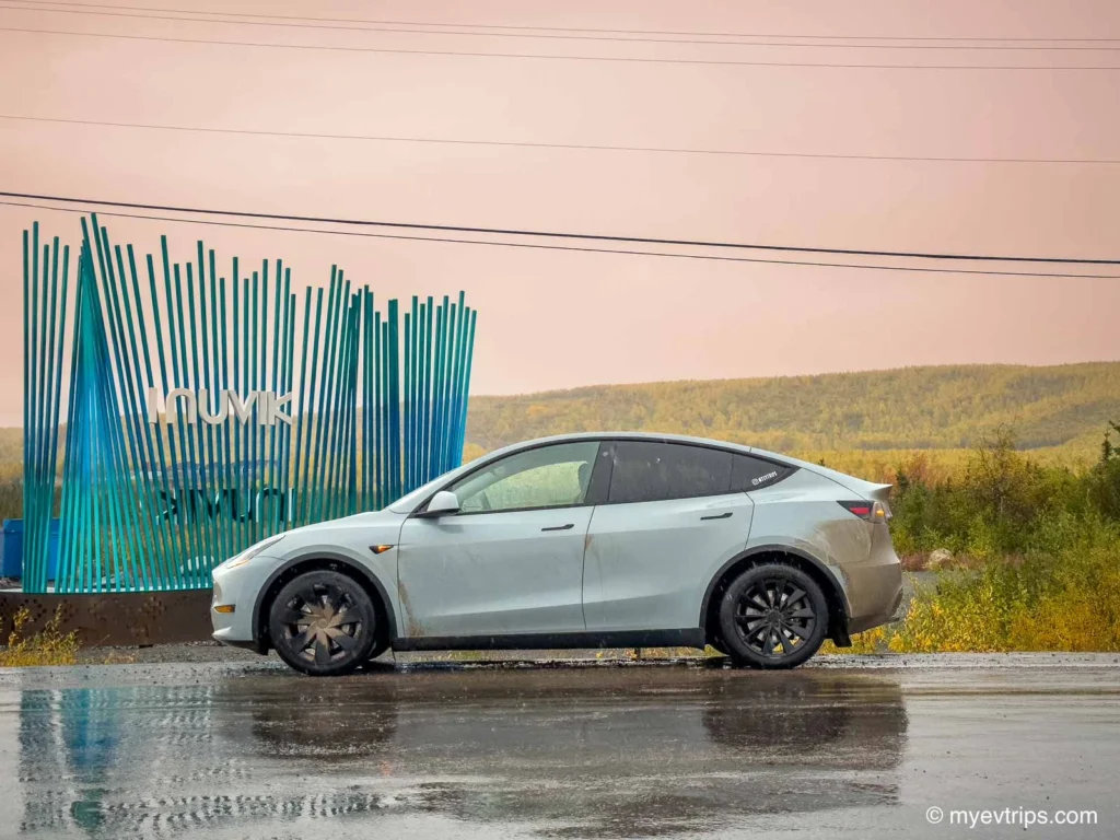
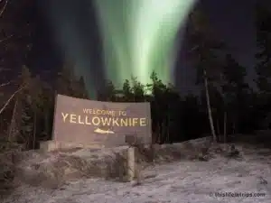
Leg 5: Inuvik to Tuktoyaktuk — Driving to the Arctic Ocean
I topped up to 95% and set out for the final push — the Inuvik to Tuktoyaktuk Highway, ~150 km each way. After the challenges of the Dempster, I figured this leg would be the easy part. But before getting too confident, I had to deal with the ongoing tire situation once more.
I stopped at Polaris Tires, hoping to finally buy a proper replacement. The owner was nowhere to be found, despite the shop in Fort McPherson calling ahead the day before. After some asking around, I eventually tracked the owner down.
My options were limited, so I bought a mismatched 19″ tire that didn’t meet the OEM specs — more for peace of mind than anything else. It set me back $480, but it was worth it just to have something in the trunk.
While I waited for the tire to be put on my rim I asked if I could top up using his Tesla L2 charger. To my suprise, this was a hard no.
The owner said it wasn’t worth his investment and was going to be taking it out. This was super disappointing and odd as, to my understanding, the charger was donated. He was also charging $100 per charge and could always charge more if needed.
I think it was the fact that he worried about people stealing power so he turns it off when not in use and has people, although very few at this point, trying to track him down to use it and can’t be bothered.
Back on the road, I quickly realized this drive wouldn’t be the “cakewalk” I’d imagined. The first stretch of highway was a mess — thick, sticky mud that clung to the tires and pulled at the car. Traction was nearly nonexistent, and the ruts were deep that getting stuck was a high possibility.
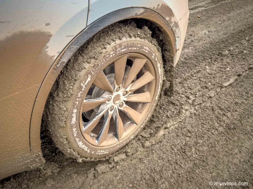
I crept along at barely 40–50 km/h, convinced I was one bad slide away from getting stuck. Each time I dropped into a rut, I wondered how much worse it would be on the way back if the rain kept up…
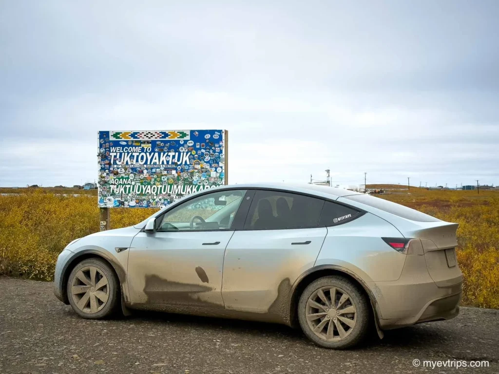
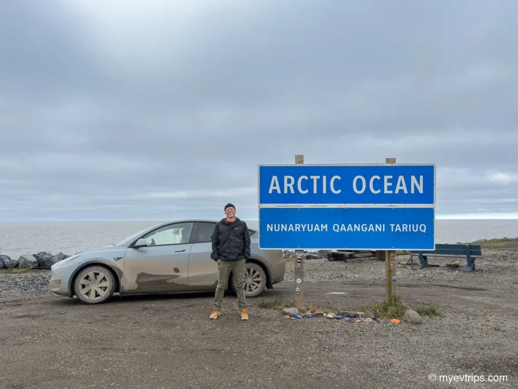
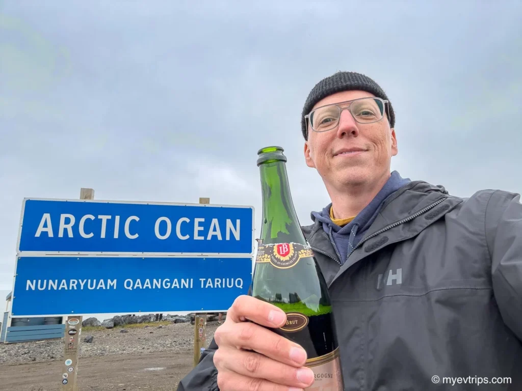
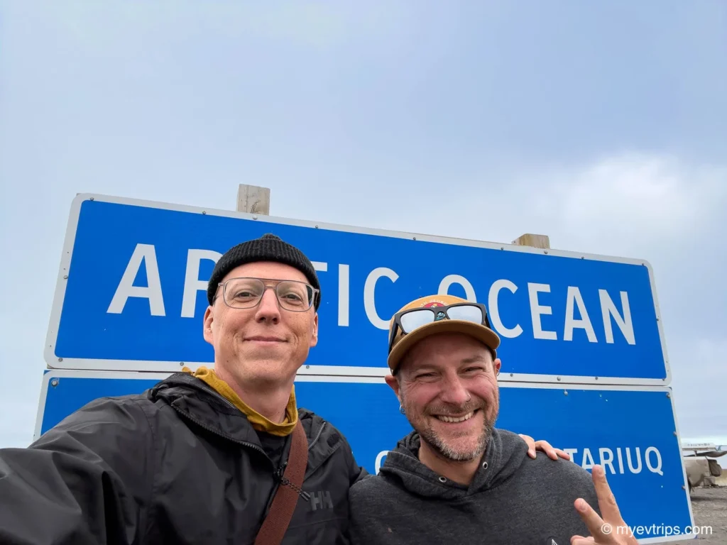
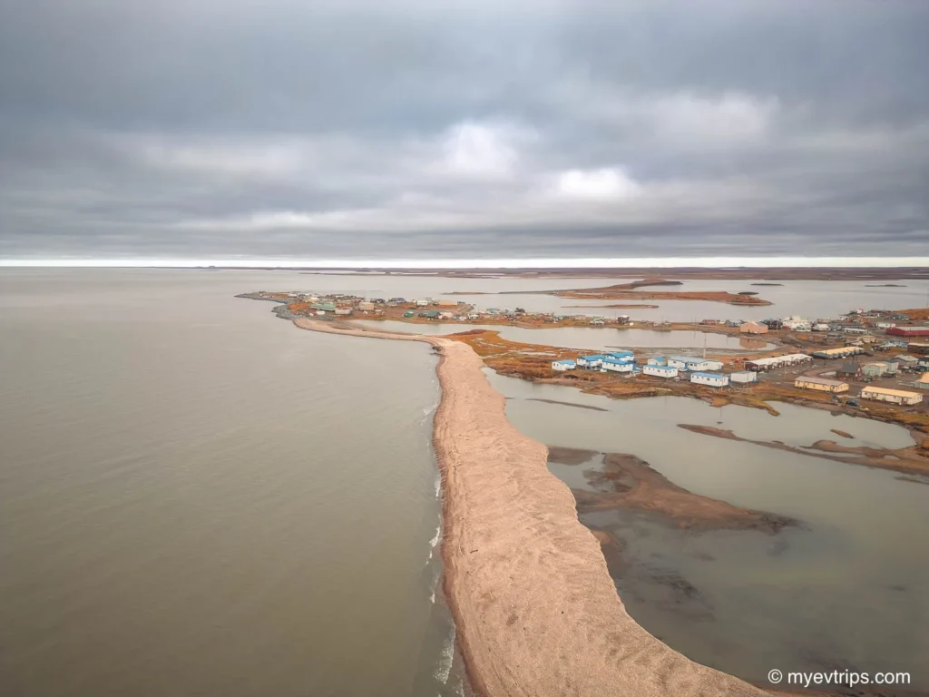
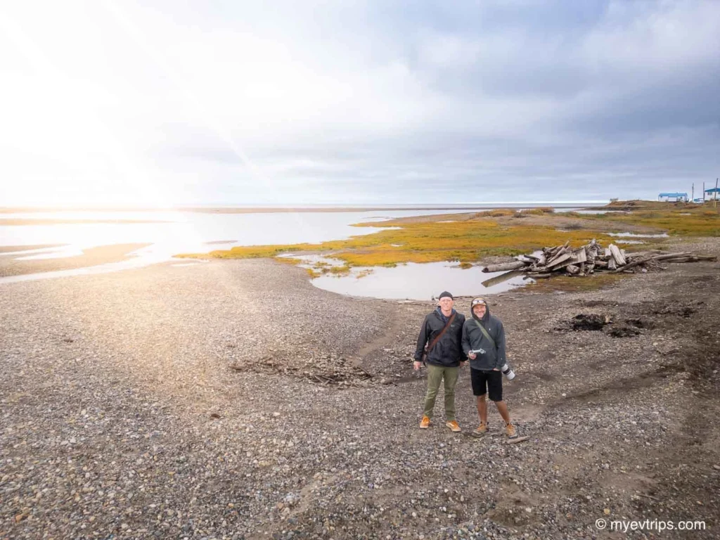
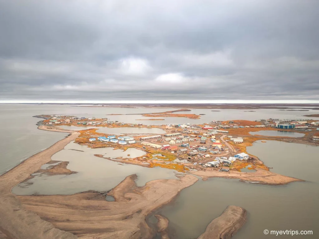
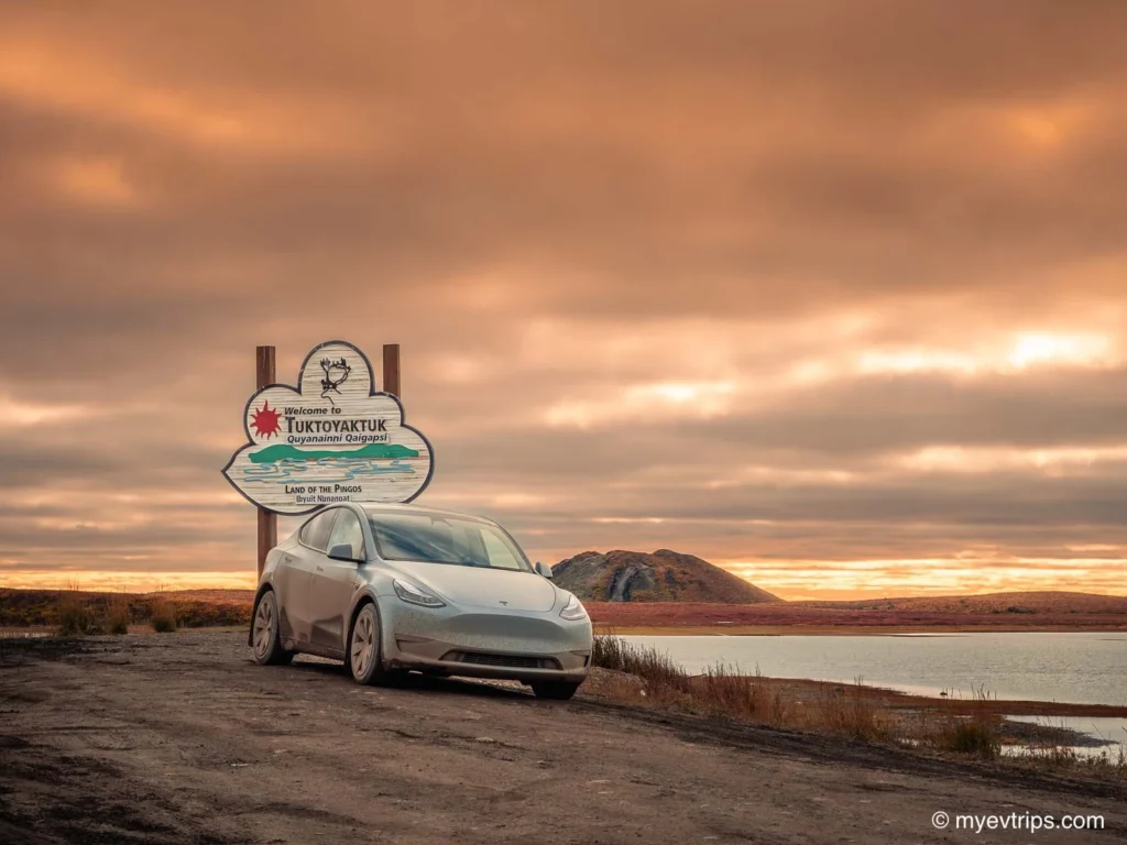
Reaching Tuktoyaktuk felt surreal — the literal end of the road. After days of flats, mud, and slow going, the moment the Arctic Ocean came into view hit hard. Relief, pride, and exhaustion all rolled together.
We popped a bottle of champagne, took the obligatory photos at the Arctic Ocean sign, and Aaron took the plunge — a quick polar dip to make it official.
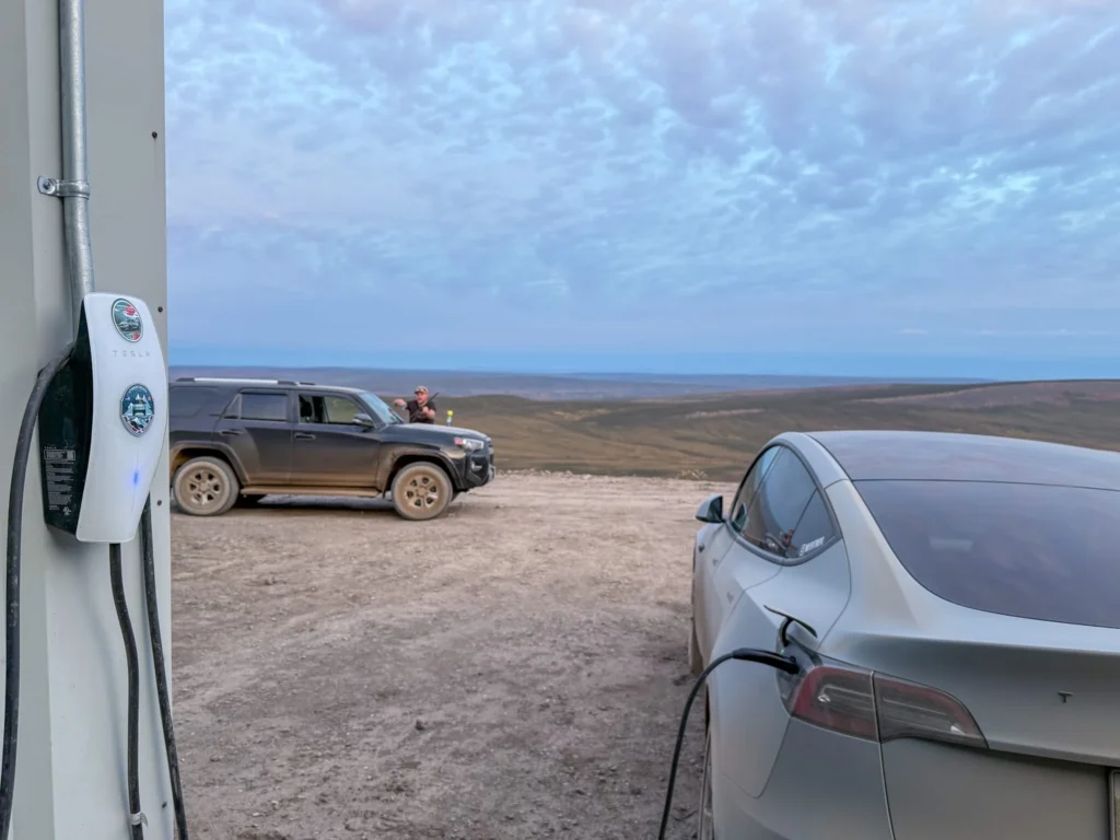
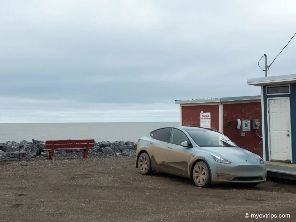
I plugged into the campground destination charger, which proved far more reliable than the one at the Hamlet office. A Rivian driver we’d met earlier reported getting only 4 kW there, but I was able to pull a steady 10 kW — more than enough to comfortably make the return.
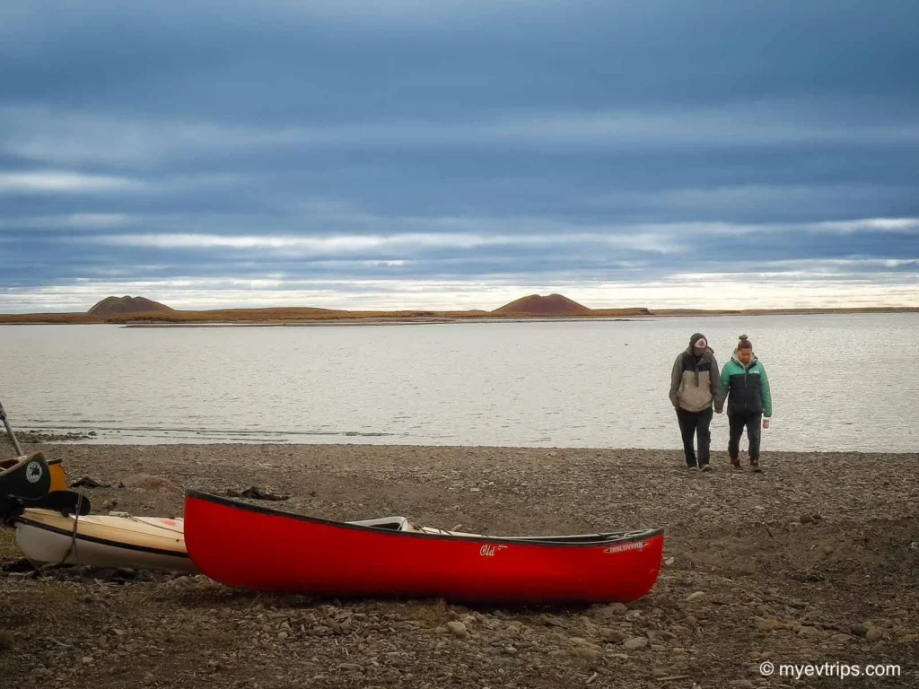
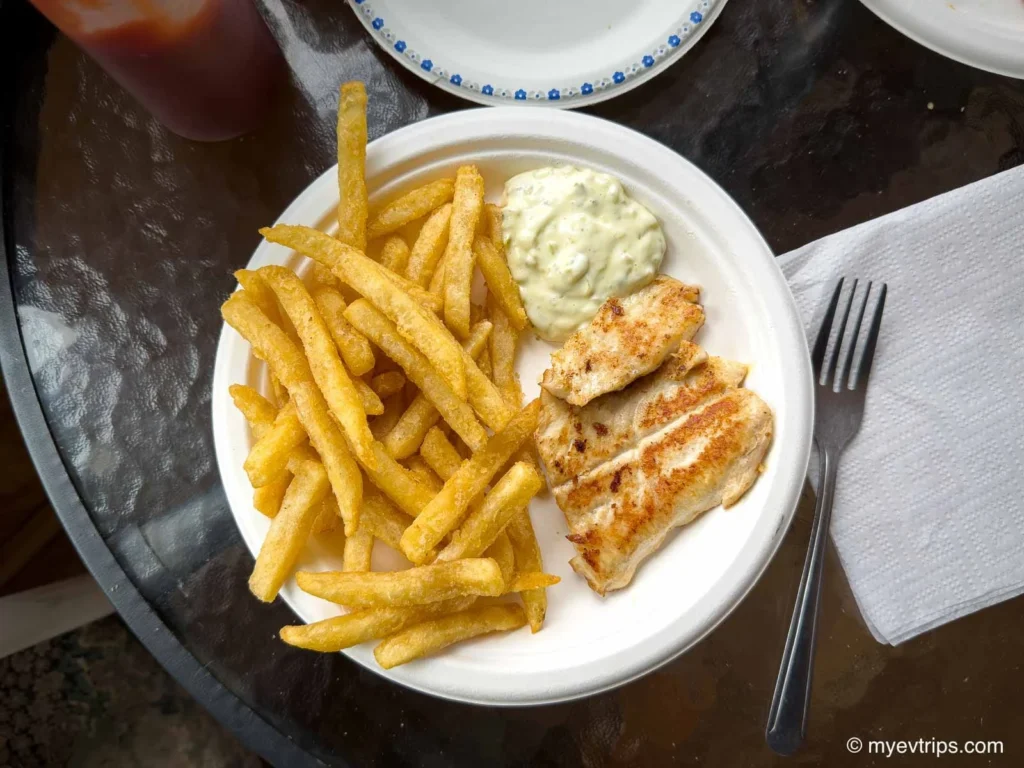
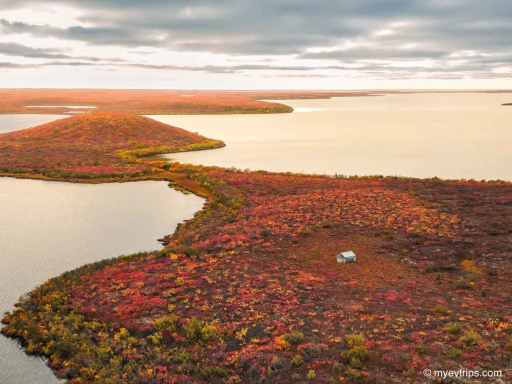
While charging, we grabbed a hot meal at Grandma’s Kitchen (sadly, no muktuk on the menu), then took a short walk around town before heading south, stopping at the Pingo Canadian Landmark to take in the view one last time.
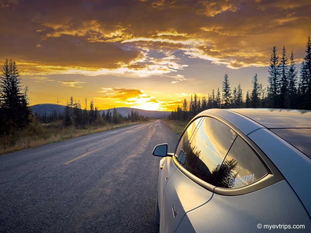
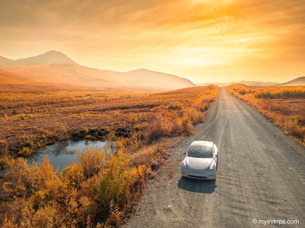
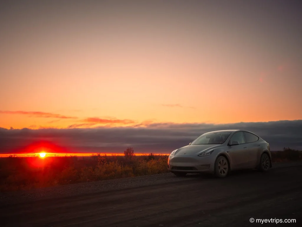
On the drive back, the sky began to clear, revealing one of the most spectacular and drawn-out sunsets I’ve ever seen. The light stretched endlessly across the tundra, painting the mud-caked highway in gold.
I’m not a religious person, but it genuinely felt like the gods were shining — drying up the roads, making them passable, and finally cutting us a break after days of challenges.
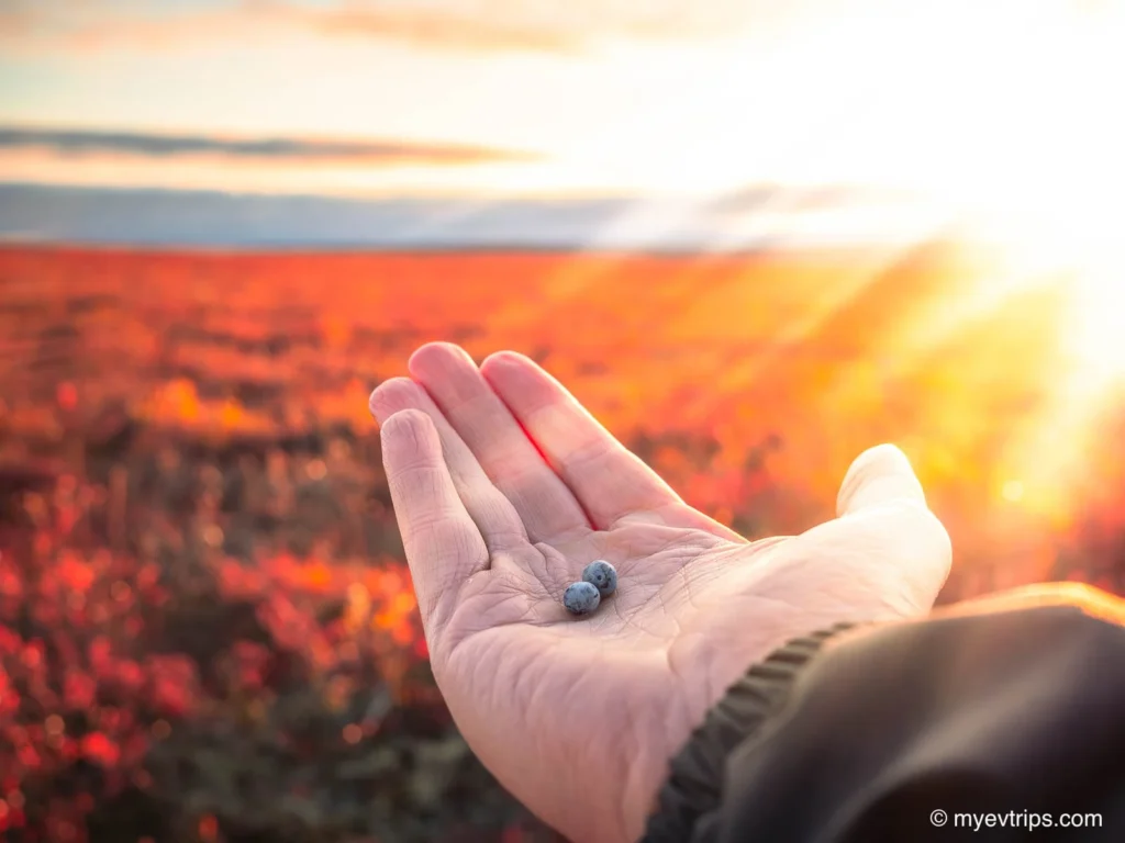
A few locals flagged us down not long after, worried they’d spotted grizzly bears in the distance while berry picking. Aaron’s zoom lens confirmed it was actually a herd of caribou, grazing under the fading light. We joined them picking blueberries and Labrador Tea — the perfect ending to what finally felt like a victory lap.
Watching the locals’ cautious respect for the land was an awakening moment too. Just a few days earlier, I’d been crouched roadside taking photos of distant bears — something they’d never dream of doing. Up here, people know better than to tempt fate. It was a quiet reminder that I was a guest in this landscape, and nature always calls the shots.
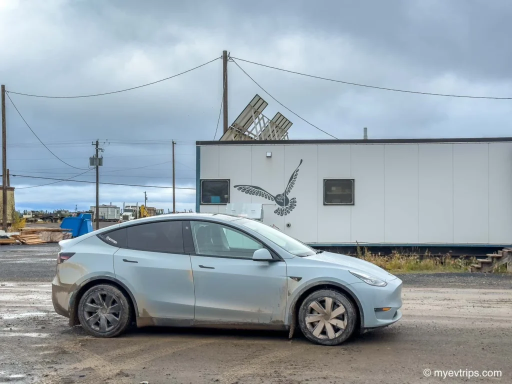
Before calling it a night, we pulled into a car wash in Inuvik to blast off the thick, caked-on mud that we picked up. Watching it slide away felt symbolic — a clean slate after an adventure that had tested both car and driver to their limits.
Wrapping Up the Northbound Journey
From Vancouver to the Arctic Ocean, the Dempster Highway Canada route tested my limits. I faced flat tires, brutal mud, a blown buffer, and charger uncertainty. But I also met incredible people, saw remote beauty few ever witness, and proved an EV can handle the Dempster — with planning and patience.
This was more than a road trip. It was a connection to my roots, a test of technology, and one hell of a story.
Stay tuned for the return trip report (coming soon!) — it wasn’t as dramatic but still filled with northern charm and stunning stops…and a little drama.
For more road trip stories, gear tips, and Tesla tricks, explore:
SAVE ON A NEW TESLA!
Thinking of buying a Tesla? Use this referral link to get up to $1,300 off!*
*As of August 2024, Tesla has reinstated its referral program and introduced attractive financing options!
Pingback: Watson Lake Sign Post Forest: A Must-See Yukon Roadside Stop
This is the kind of northern adventure Id love, minus the flat tires and charging drama! Those tire tales on the Dempster are a hoot – seriously, shale and luck, right? And while I admire the sheer EV grit, some parts sound like a wild, mud-covered road trip movie. The charging improvisations are brilliant, though – turns out northern hospitality has some… unique energy. Kudos to the author for making it look like the most scenic drive ever despite the patch job saga! On a serious note, though, those charging infrastructure gaps are concerning. Still, what an epic journey to the top of the world! Now, if only I could find a CHAdeMO adapter party up north…
Pingback: Visiting Liard River Hot Springs BC: A Complete Guide
Pingback: The Sourtoe Cocktail in Dawson City: Yukon Jack & Human Toe
Congratulations on making it north but it’s notable that there is no write up on the drive back out? Did the author just arrange for a flatbed truck to haul the Tesla out or was it driven back out through another round of overcoming difficulties of charging and flat tires? Driving any sedan car with road rated passenger tires on the Dempster highway graded gravel road for 1100 km on is challenging enough but adding the complexity of finding chargers to make it work at all, and the wait times and charges, is why most people still do it with gasoline powered trucks and SUVs.
Hi Anthony, see here is the report from the drive south!
https://myevtrips.com/dempster-highway-ev-road-trip-report-southboun/
Pingback: Big Life Changes, Big Adventures, and One Of My Biggest EV Road Trips Yet – This Life in Trips